Browse categories
Log in
Sign up
Canada Provinces Free Stock Images
Safe search
Include:
RF-LL
Public Domain
Prince Edward Island Flag Waving Vector Illustration on White Background. Provinces Flag of Canada
Map Canada. Poster map of provinces and territories of Canada
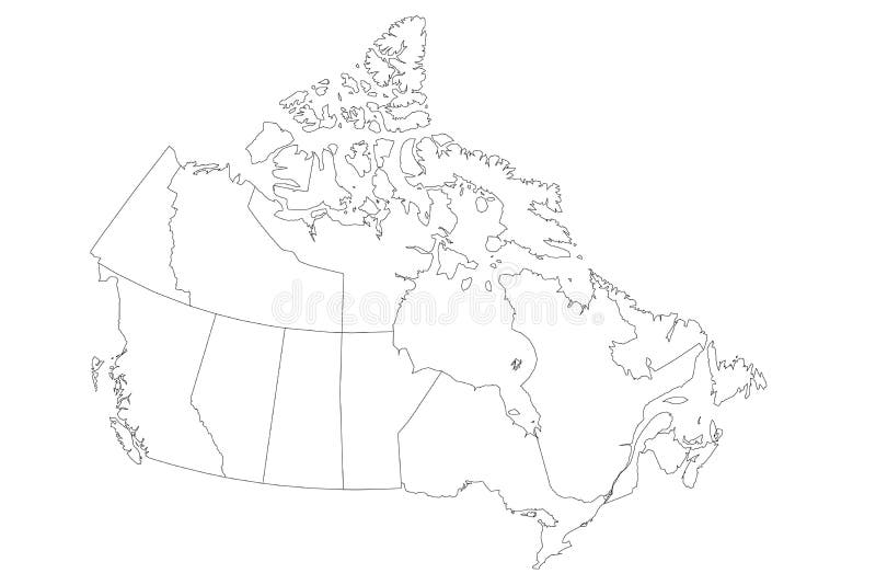
Map of Canada divided into 10 provinces and 3 territories. Administrative regions of Canada. Blank white map with black
Map Canada. Poster map of provinces and territories of Canada
Canada map with provinces and cities, vector illustration
Prince Edward Island Flag Waving Vector Illustration on White Background. Provinces Flag of Canada
Canada map. Poster map of Canada. Provinces and territories of Canada. Vintage print for typography, t-shirt, poster. Vector illus
Map Canada. Poster map of provinces and territories of Canada
Map Canada. Poster map of provinces and territories of Canada
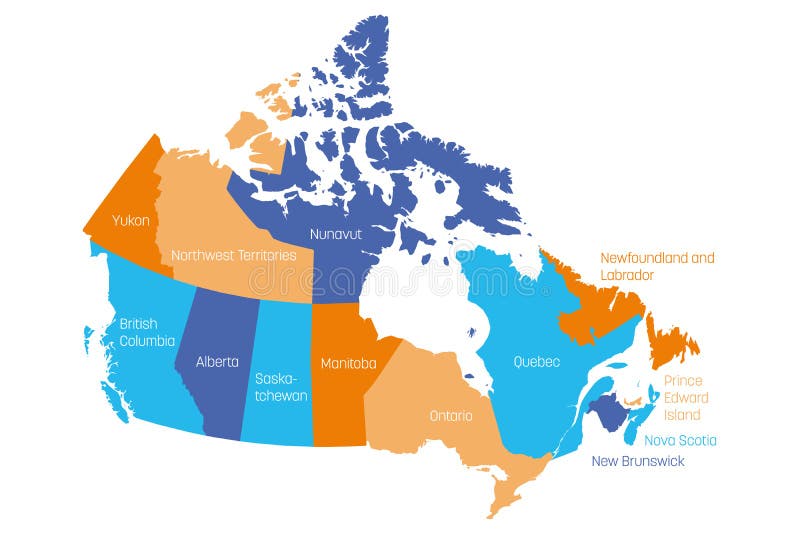
Map of Canada divided into 10 provinces and 3 territories. Administrative regions of Canada. Multicolored map with
Map Canada. Poster map of provinces and territories of Canada
Map Canada. Poster map of provinces and territories of Canada
Map Canada. Poster map of provinces and territories of Canada
Detailed Earth at night. Western and Northern Canada - British Columbia, Alberta and other provinces
Nova Scotia Flag Waving Vector Illustration on White Background. Provinces Flag of Canada
Next page
2
/ 3
Home
Search for Canada provinces free images