Browse categories
Log in
Sign up
Expanded Free Stock Images
Safe search
Include:
RF-LL
Public Domain
Sponsored images by
Dreamstime
Metal expanded lath on white background
Smiley Face Vector Line Icon Set. Contains such Icons as Happy, Cheeky, Emoji and more. Expanded Stroke
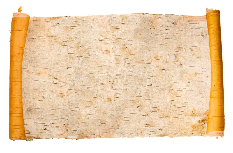
Expanded birchen bark scroll
Law and justice icons set vector illustration. Contains such icon as Attorney, Criminals, Cyber Law, Criminal and more. Expanded
Expanded Optical Check
Skin Layer Vector Line Icons. Contains such Icons as Acne, Dry, Moisturizer, Pimple, Cells and more. Expanded Stroke.
Birds, Animals. Peacock With Expanded Feathers. Thailand, Asia.
Birds, Animals. Peacock With Expanded Feathers. Thailand, Asia.
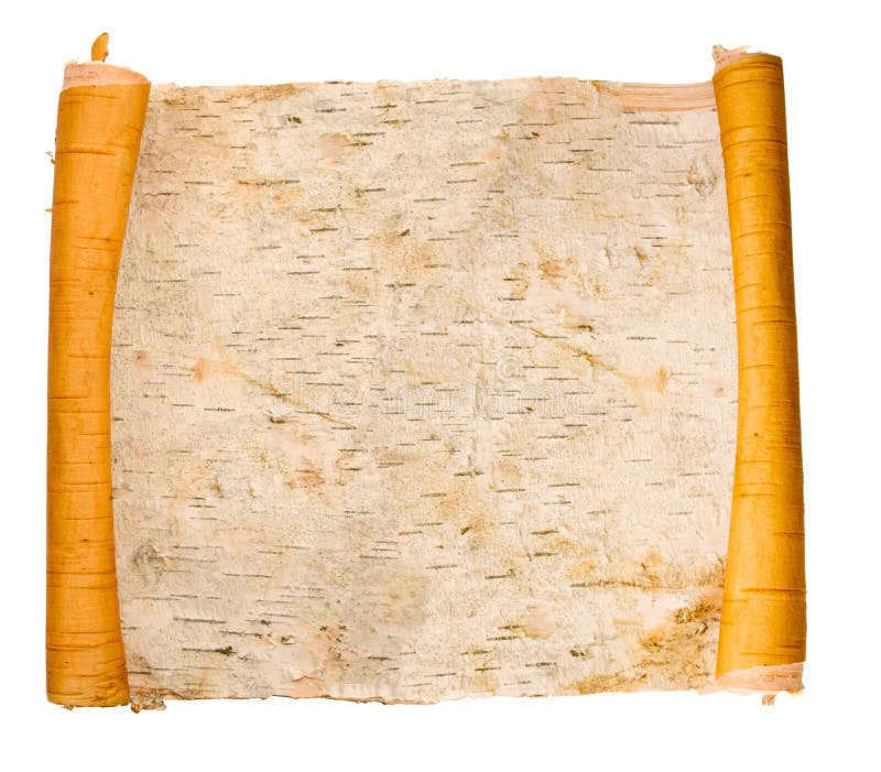
Expanded birchen bark scroll
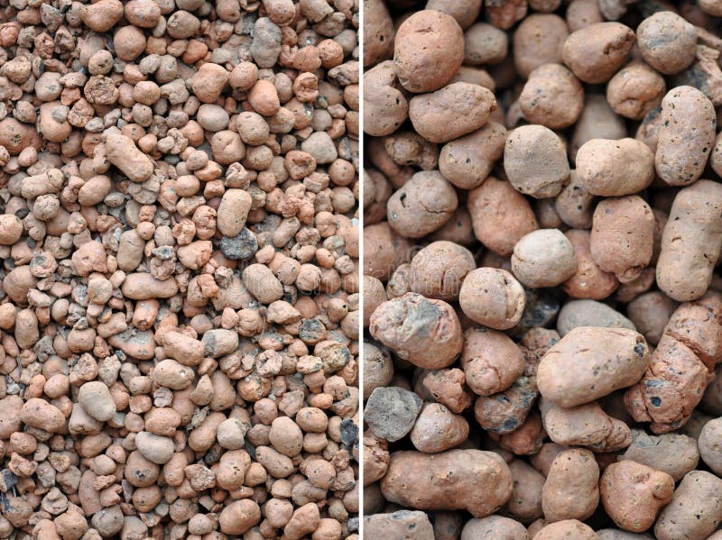
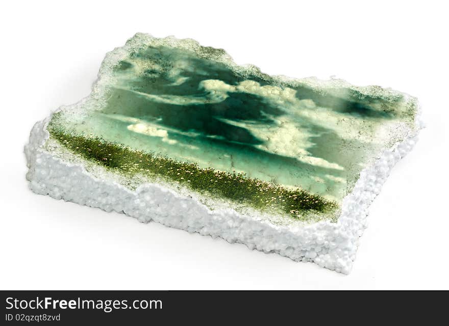
Expanded clay
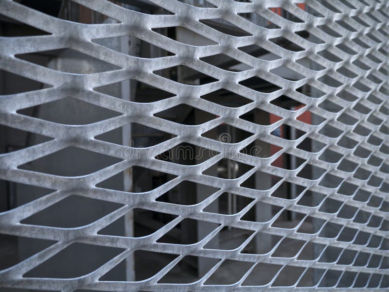
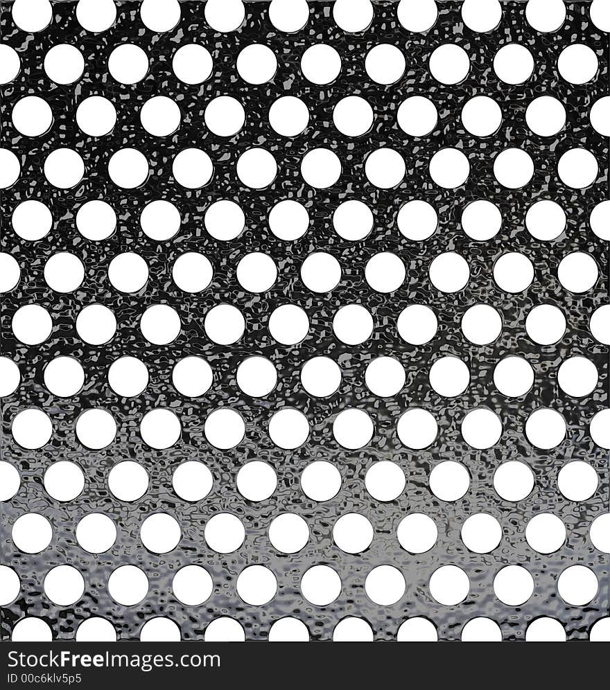
Expanded metal
Expanded clay
Tree Vector Line Icon Set. Contains such Icons as Wood, Plant, Pine, Cactus, Bamboo and more. Expanded Stroke
Farming icons set vector illustration. Contains such icon as agriculture, planting, fertilizer, fence and more. Expanded Stroke
Book icons set vector illustration. Contains such icon as Open book, Bookmark, Magazine, Novel and more. Expanded Stroke
Expanded polystyrene beads
Expanded polystyrene beads
Willow. Early spring willow catkins. A branch with swollen buds for Easter decoration. A willow branch pointing upwards as a symbo
Dumbbells
Holy steel
Colorful rice
Holy steel
Steel plate
Steel plate
Finger dumbbells
Finger dumbbells
Polystyrene with picture
Expanded pussy willow buds
Orange expanded polystyrene
Finger dumbbells with blue grip
Macro shot of rubber ball with stringy tips
The Robey Traction Engine (11)
The Robey Traction Engine.
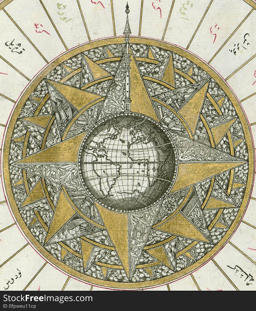
Illuminated Manuscript, Map of Western hemisphere within a windrose, from Book on Navigation, Walters Art Museum Ms. W.658, fol.24
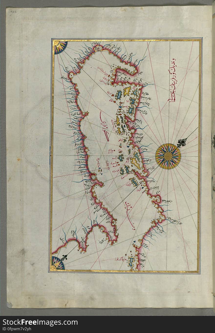
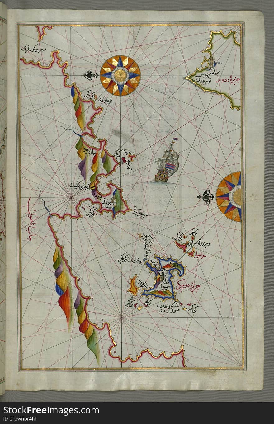
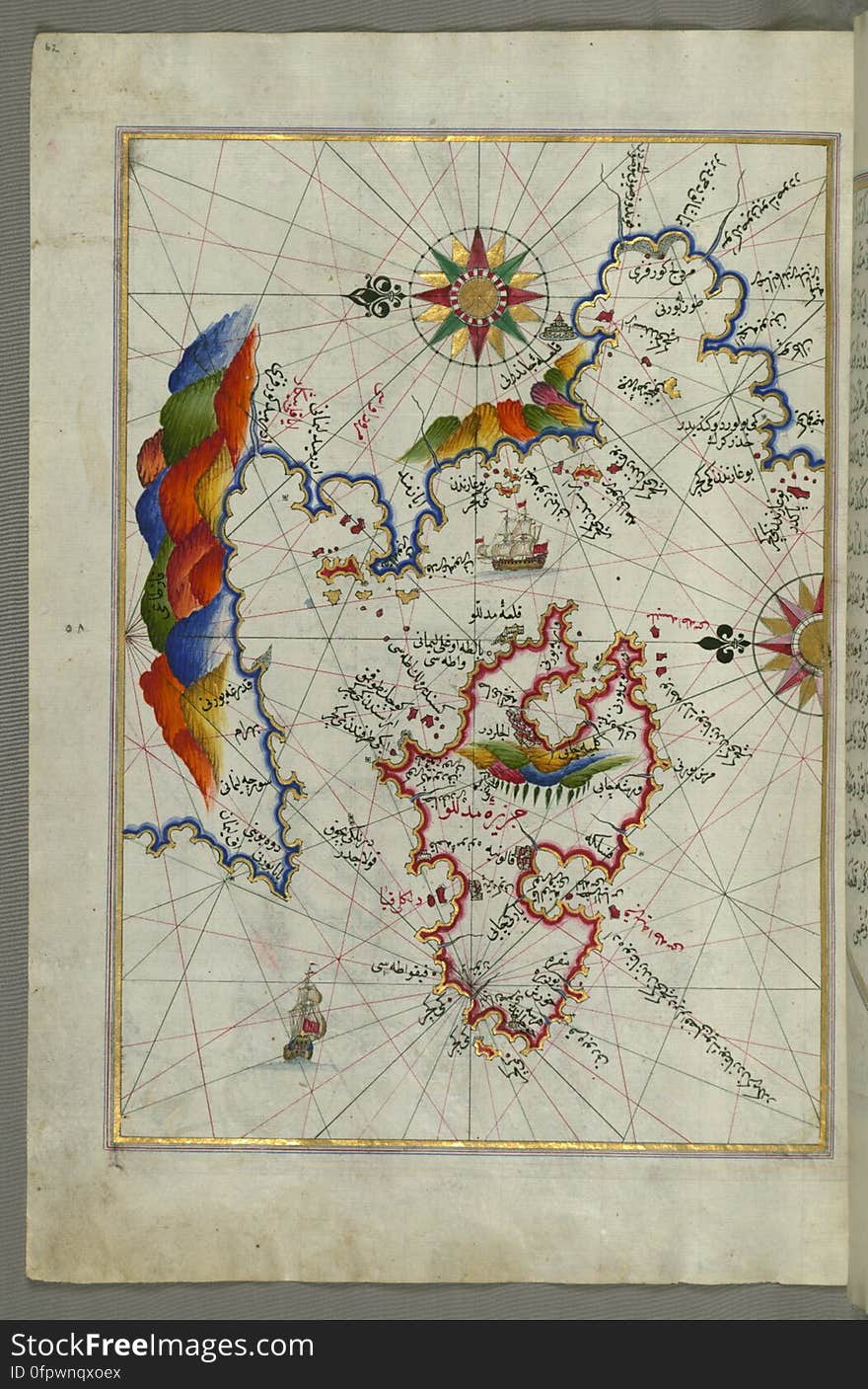
Illuminated Manuscript Map of the Islands of the Adriatic Coast from Book on Navigation, Walters Art Museum Ms. W.658, fol. 208a
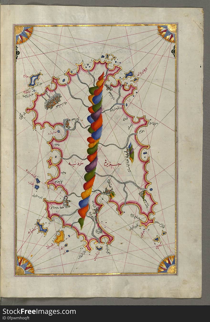
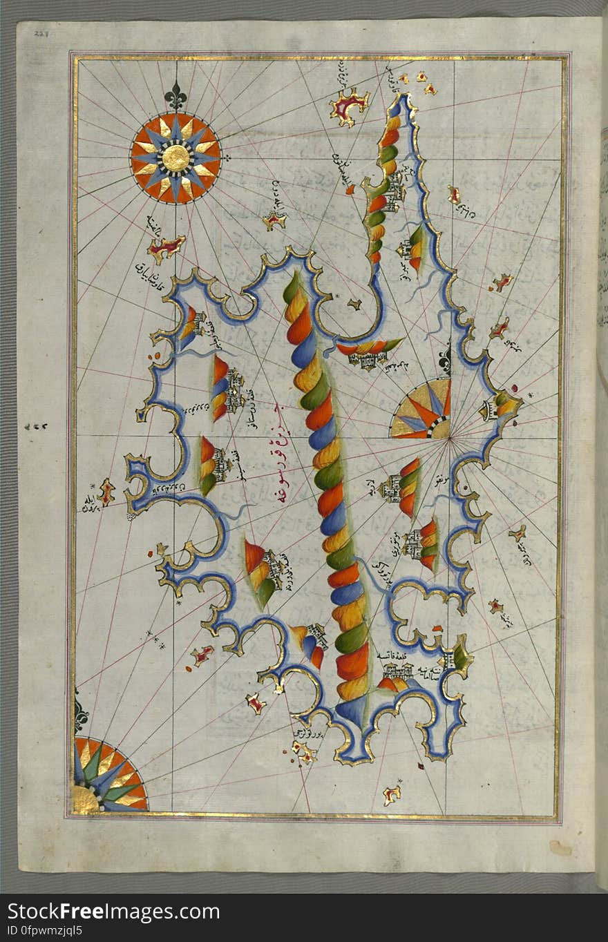
Illuminated Manuscript Map of Sardina from Book of Navigation, Walters Art Museum, Ms. W.658, fol. 226b
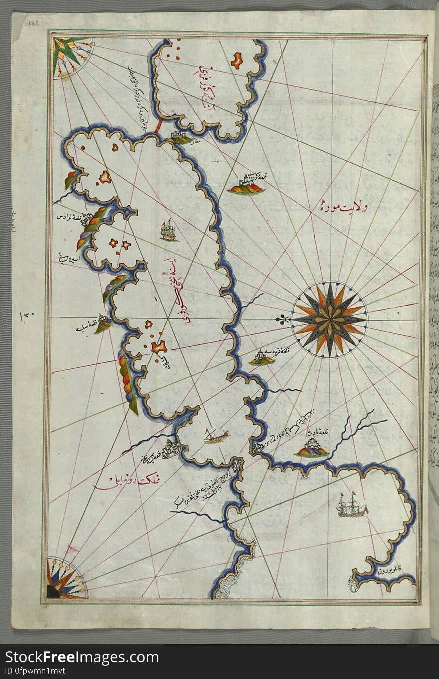
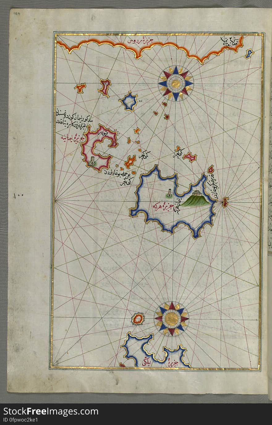
Illuminated Manuscript Map of Saronikos (Aiyina) Bay, from Book on Navigation, Walters Art Museum Ms. W.658, fol. 133a
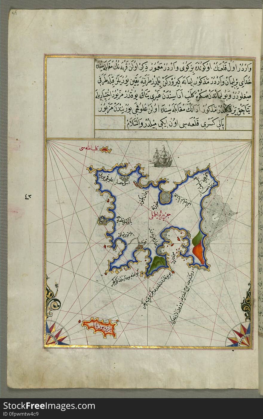
Illuminated Manuscript Map of the island of Lemnos, from Book on Navigation, Walters Art Museum Ms. W.658, fol.47a
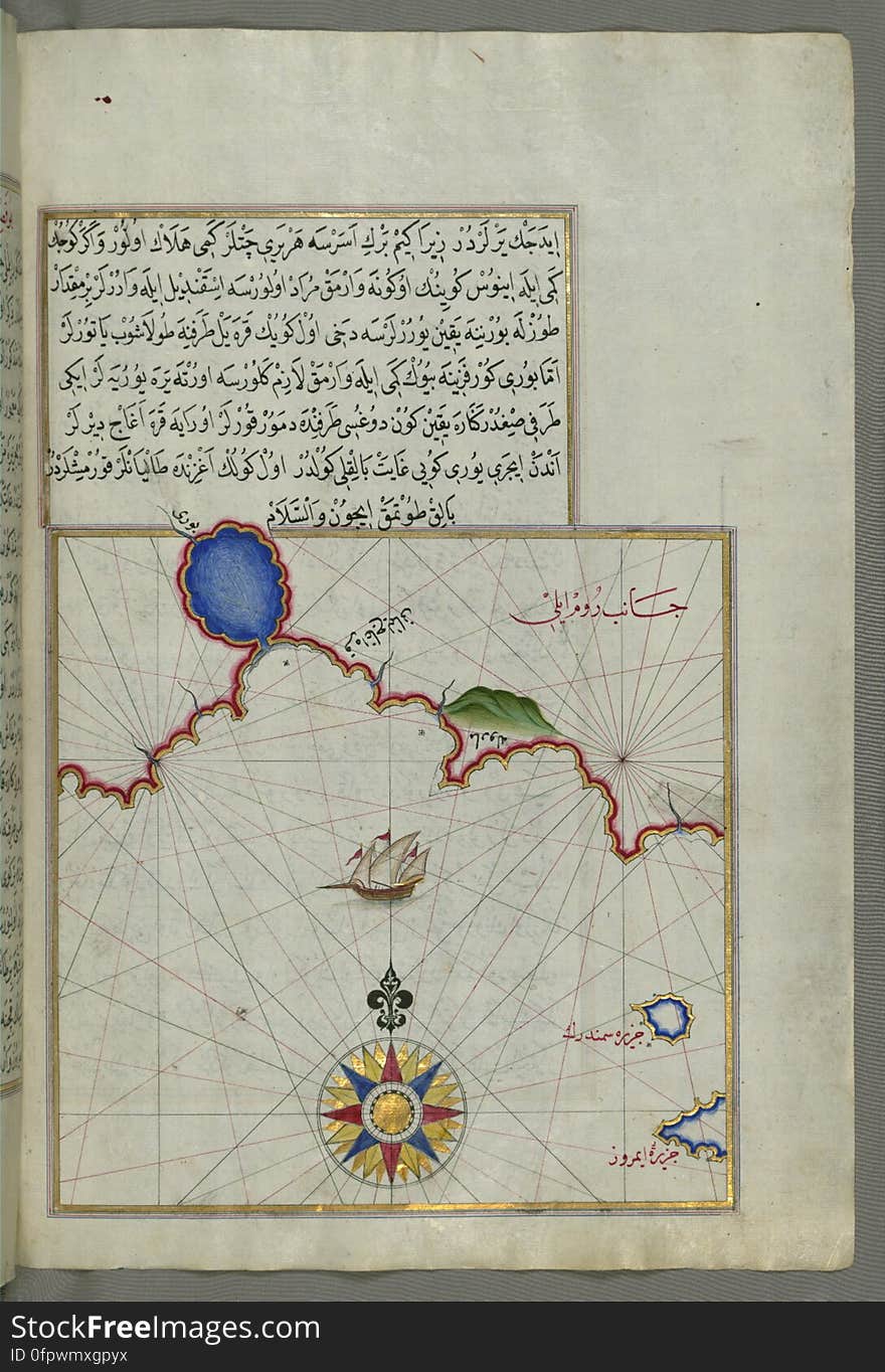
Illuminated Manuscript Map of part of the European coastline with the islands of Semendrek (Samothraki) and Imroz (
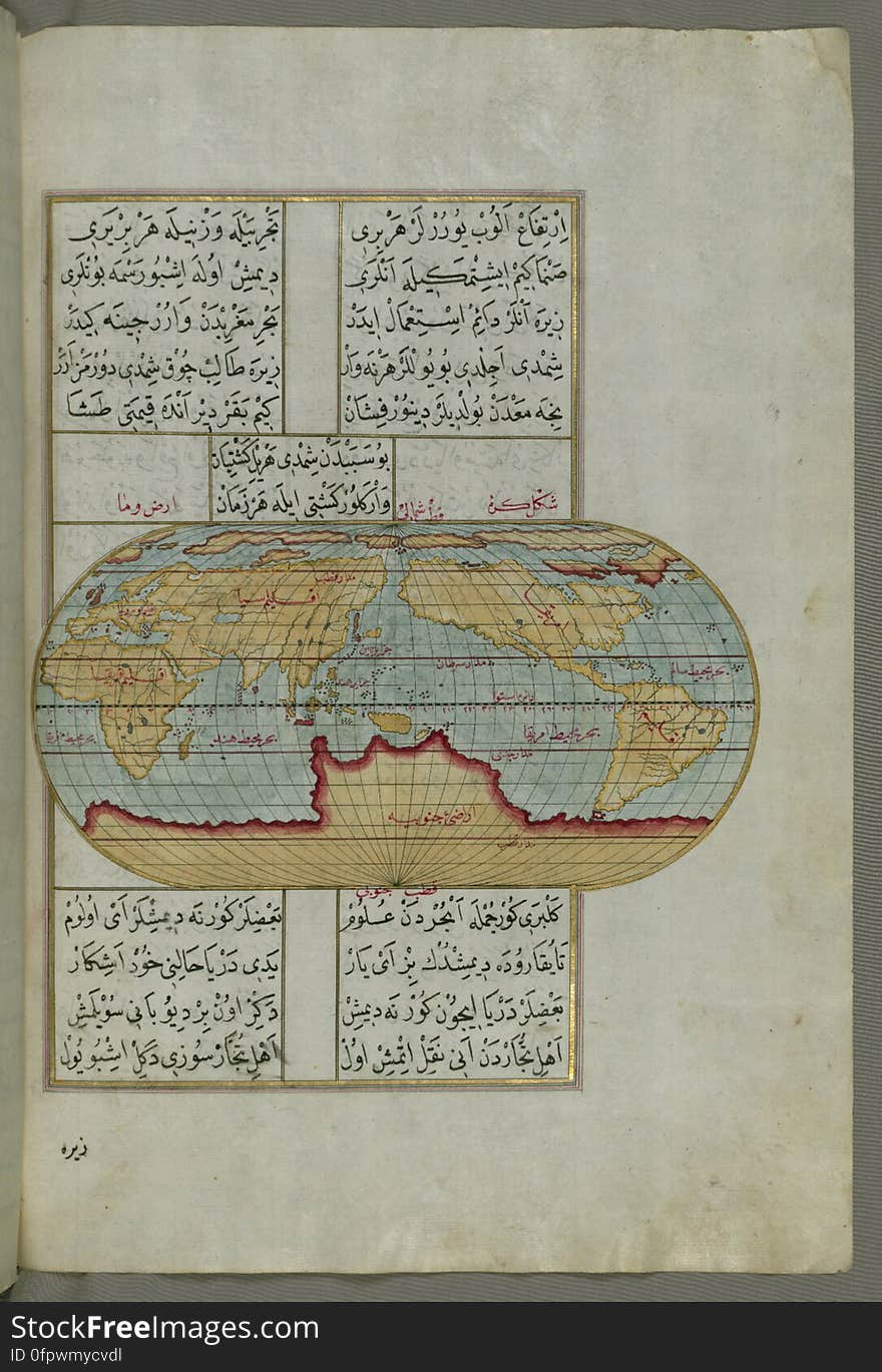
Illuminated Manuscript, Oval Map of the World, from Book on Navigation, Walters Art Museum Ms. W.658, fol.23b
Illuminated manuscript Map of Corsica, from Book on Navigation, Walters Art Museum Ms. 658, fol. 229a
The coastline of the western Aegean Sea as far south as the Island of Euboea (Evvoia, Aghrībūz, Eğriboz), from Book o
Illuminated Manuscript, Map of Western hemisphere within a windrose, from Book on Navigation, Walters Art Museum Ms. W.658, fol.24
Illuminated Manuscript Map of the islands of Skyros (İskire) and Euboea (Evvoia, Aghrībūz, Eğriboz), from
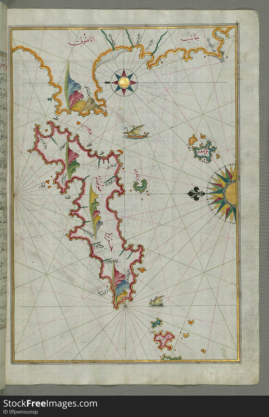
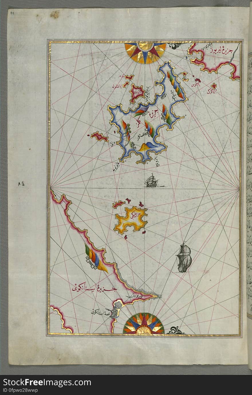
Illuminated Manuscript map of the northeastern tip of Rhodes (Rodos, Rūdūs) Island facing the Anatolian coast with the
Illuminated Manuscript Map of The island of Bozjah (Tenedos) off the coast of Anatolia, from Book on Navigation, Walters
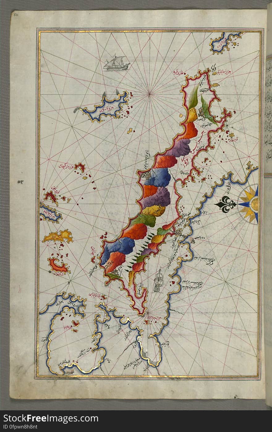
Illuminated Manuscript map of the islands of the Aegean Sea including Chios (Sakiz), Cos (Stancho, İstanköy)
Detailed map of Chios (Sakiz, Ṣāqiz) Island with its fortress and other topographical features, from Book on Navigati
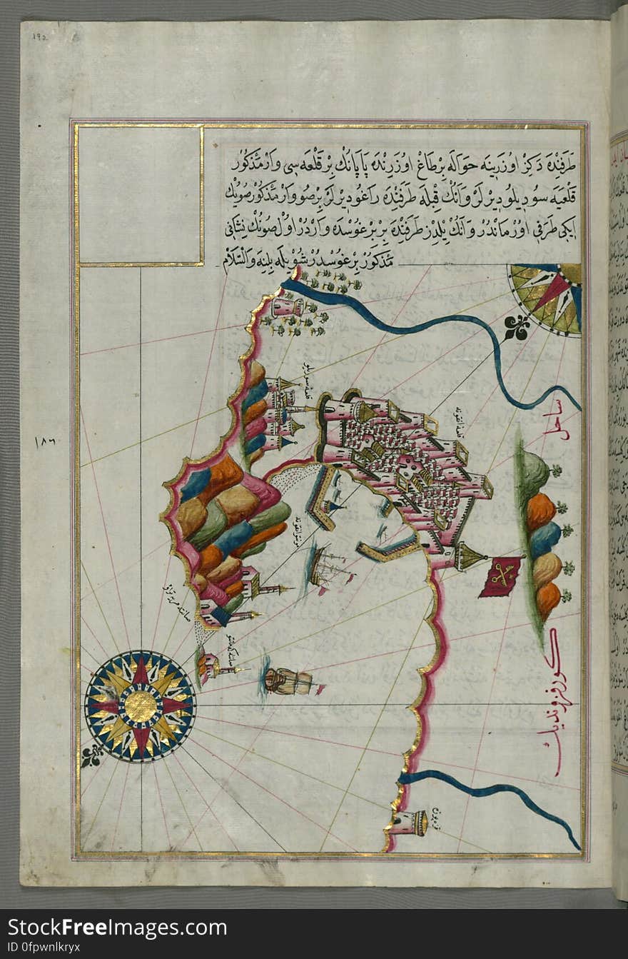
Illuminated manuscript Map of the Fortress of Ancona, from Book on navigation, Walters Art Museum ms. W.658, fol. 192a
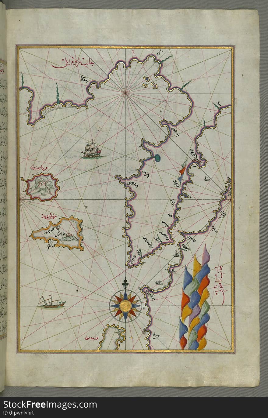
Illuminated Manuscript Map of The Islands of Semendrek (Samothraki) and Imroz (Imbros) in the Aegean Sea, from
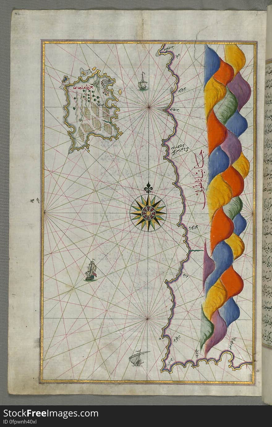
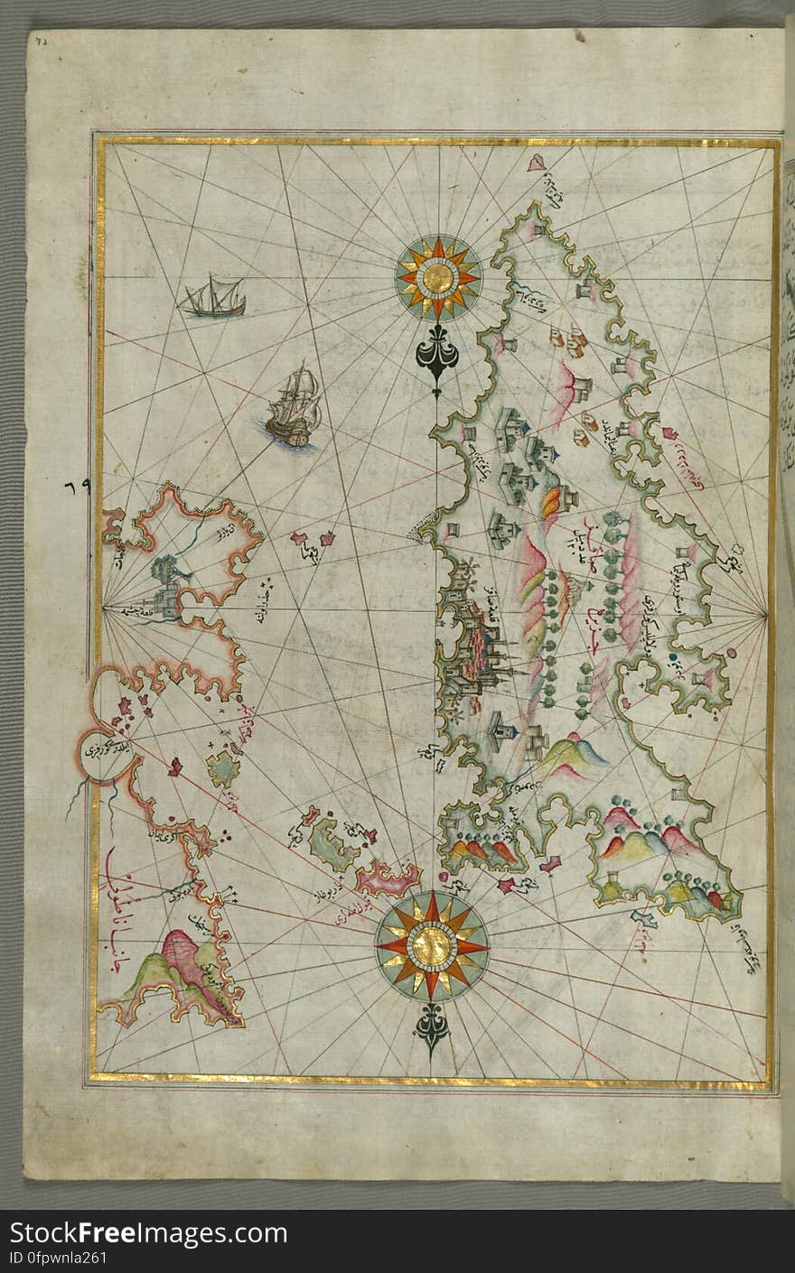
The Island of Samos, from Book on Navigation, Walters Art Museum Ms. W.658, fol.79b
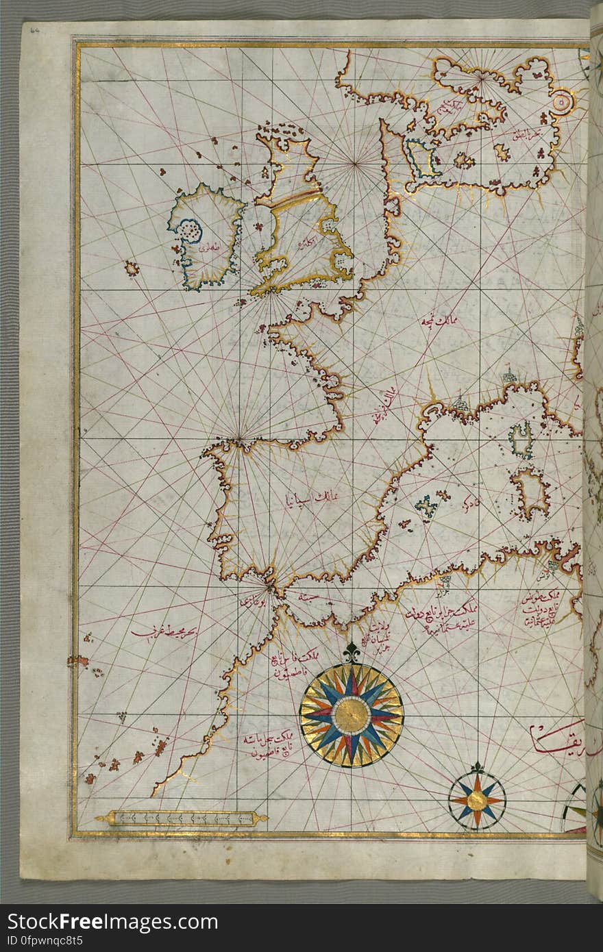
Map of western Europe and North Africa, from Book on Navigation, Walters Art Museum Ms. W.658, fol.64a
The Island of Midilli (Midillü, Mitylene, Lesvos) in the northeastern Aegean Sea, from Book on Navigation, Walters Art
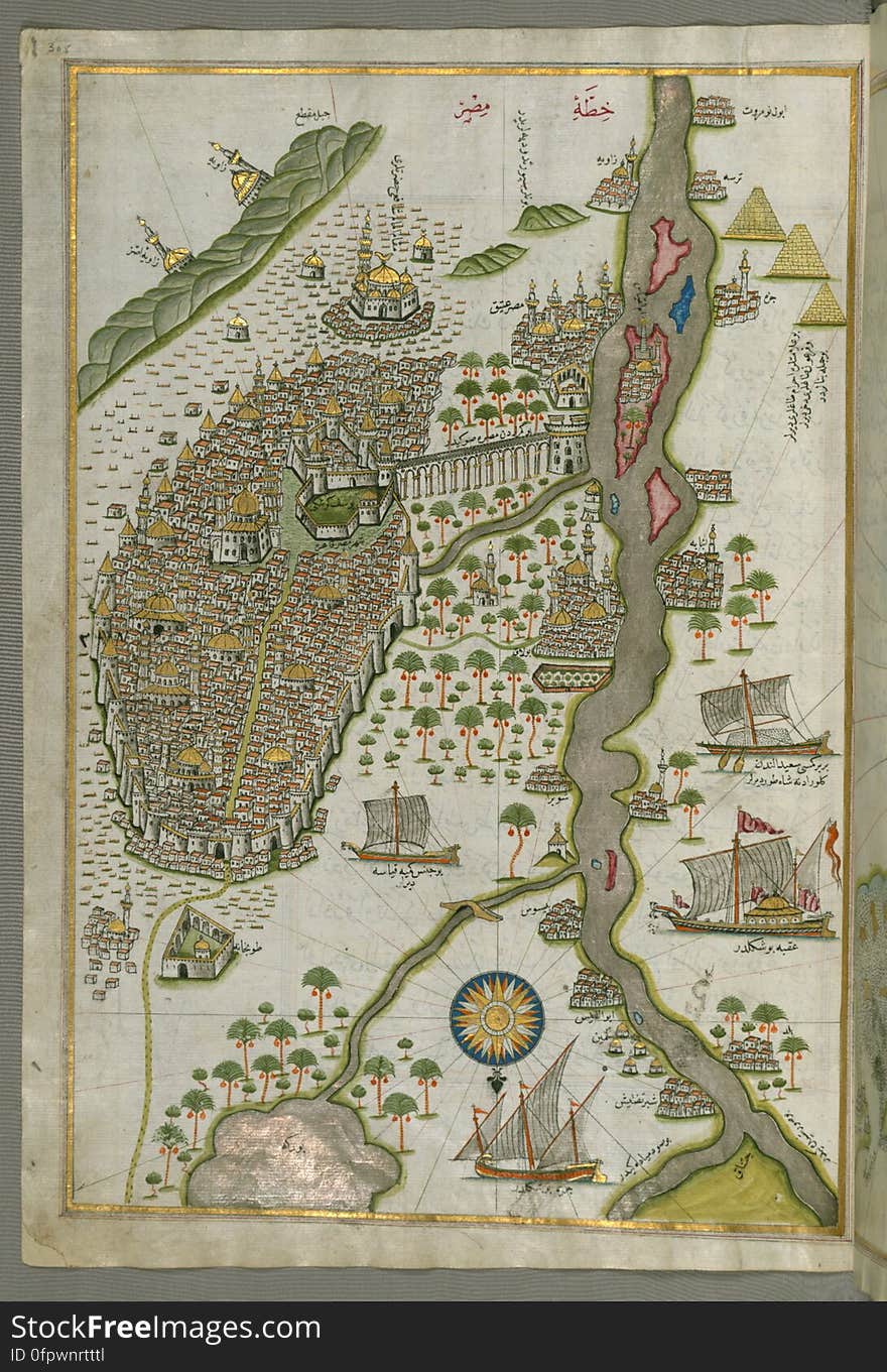
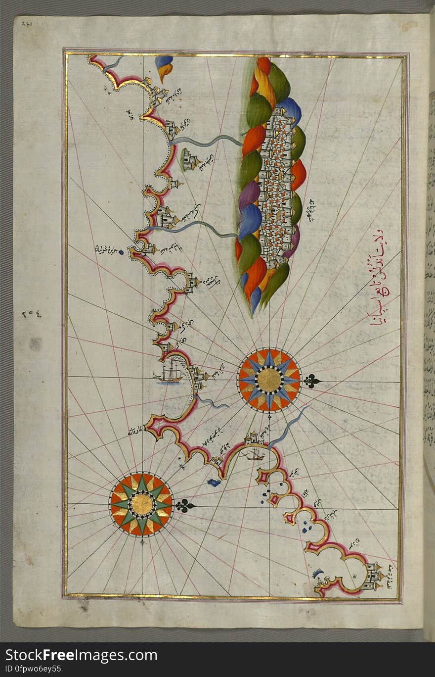
Illuminated Manuscript Map of Cairo, from Book on Navigation, Walters Ms. W.658, fol. 305b
Chios (Sakiz, Sāqiz) Island facing Kysos (Çeşme) fortress on the Anatolian side, from Book on Navigation, W
The Island of Kalimnos (Kalimaz) south of Leros in the eastern Aegean Sea from Book on Navigation, Walters Art Museum Ms
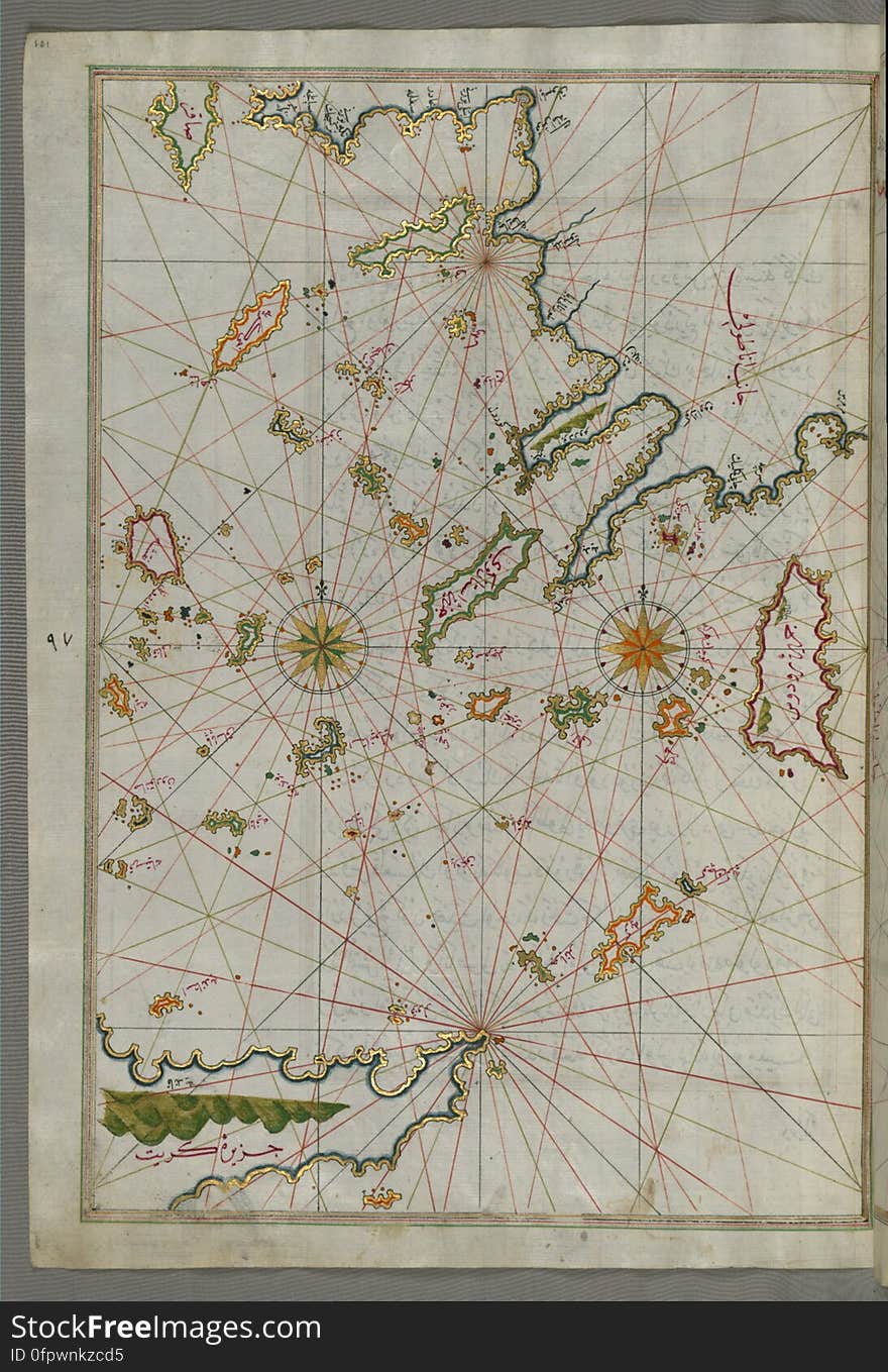
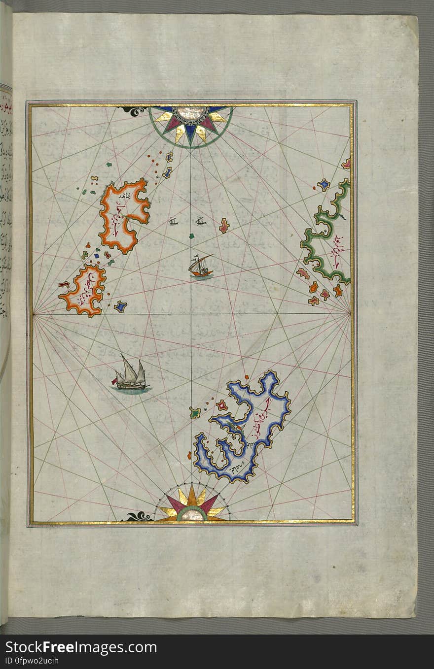
Several islands of the eastern Aegean Sea including: Leros (Līrūs) and Patmos (Bāṭnūz) from Book on Navi
Illuminated Manuscript Map of the coast of Andalusia with the city of Grenada (Gharnātah), from Book on Navigation, Wal
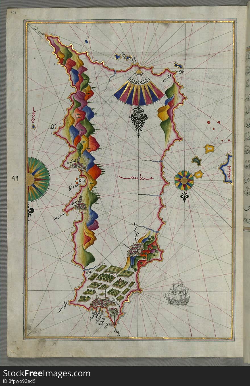
Rhodes (Rodos, Rudūs) Island from Book on Navigation, Walters Art Museum Ms. W.658, fol. 103a
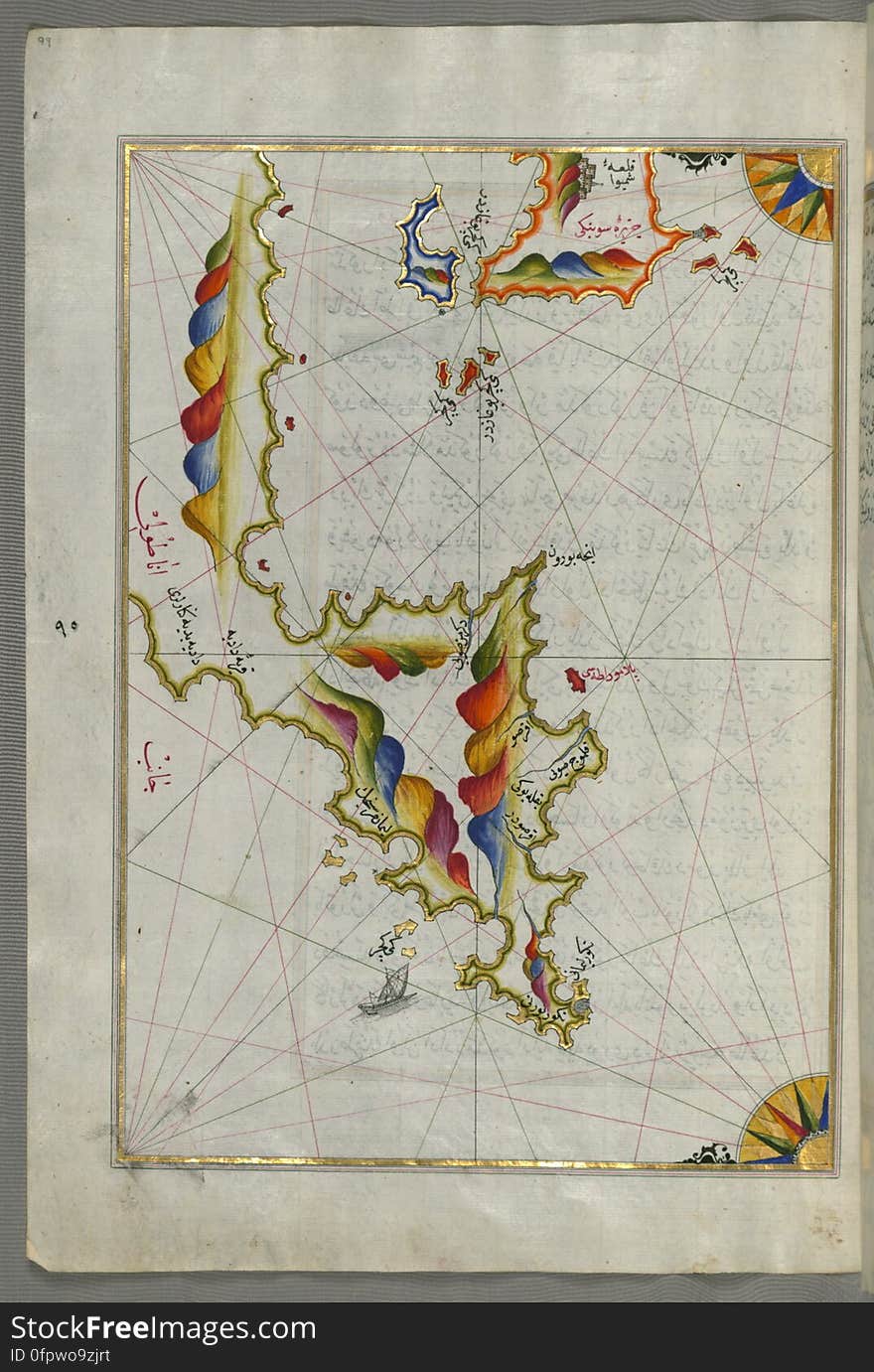
Syme (Sömbeki) island north-west of Rhodes (Rodos) island from Book on Navigation, Walters Art Museum Ms. W.6
Chalkis (Herke) island off Rhodes Island from Book on Navigation, Walters Art Museum Ms. W.658, fol.104a
Anatolian coast and the small Kara (Qarah) island east of the town of Balat from Book on Navigation, Walters Art Museum
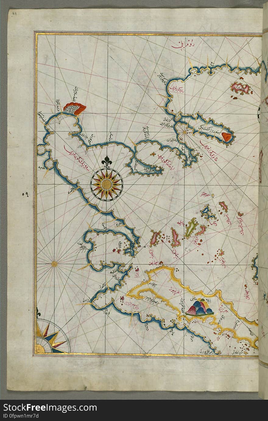
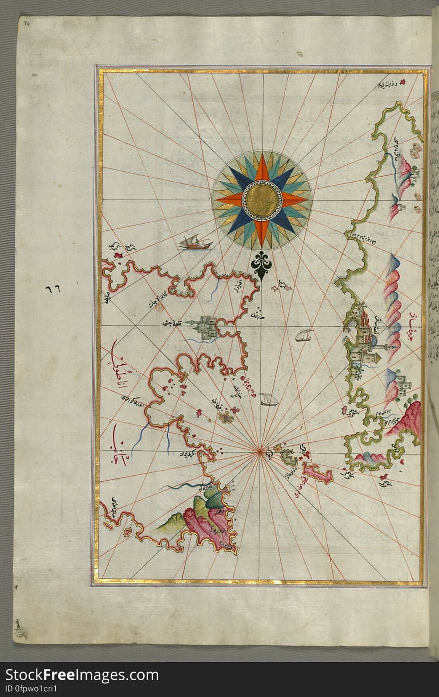
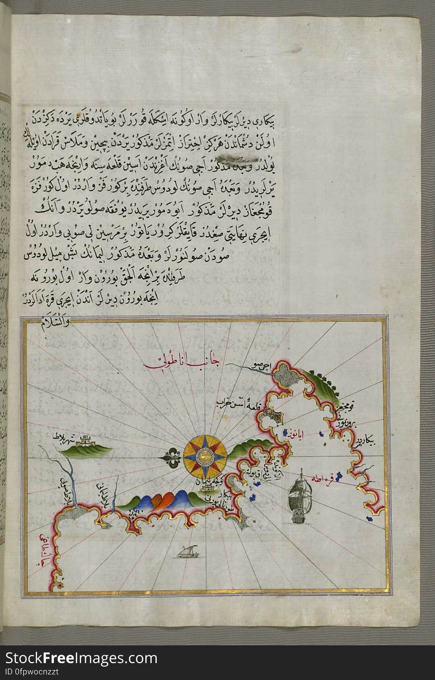
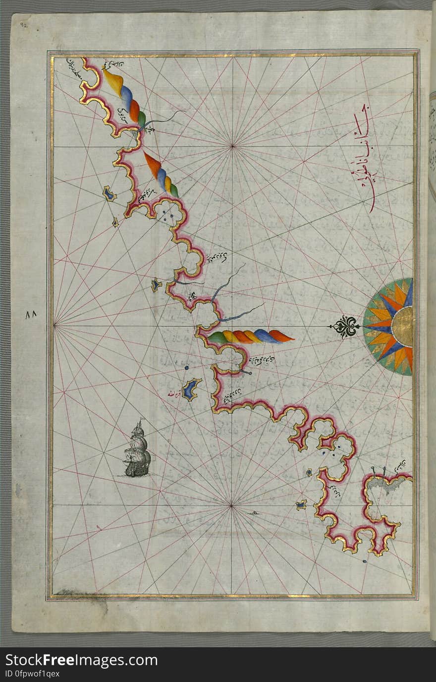
The Anatolian coast along the Kerme Bay from Book on Navigation, Walters Art Museum Ms. W.658, fol. 92a
Next page
1
/ 10
Home
Search for Expanded free images