Browse categories
Log in
Sign up
Illuminated Map World Free Stock Images
Safe search
Include:
RF-LL
Public Domain
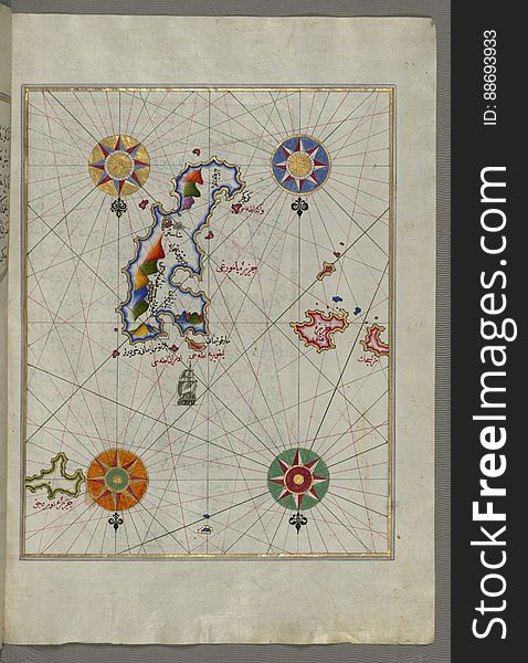
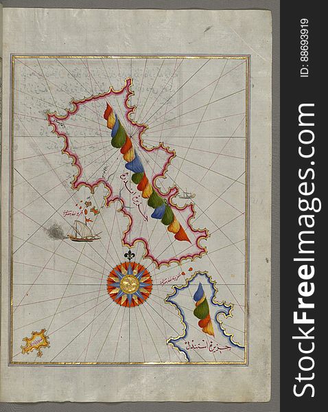
Illuminated Manuscript The Island of Amorgos (Yamurgi, Yamorki) in the southeastern Aegean Sea, from Book on Navigation
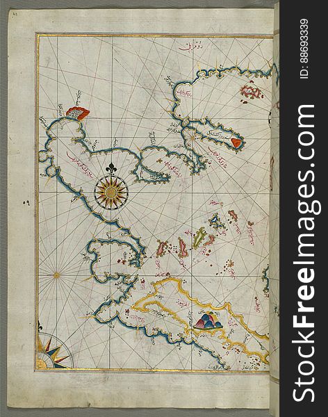
The coastline of the western Aegean Sea as far south as the Island of Euboea (Evvoia, Aghrībūz, Eğriboz), from Book o
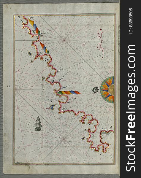
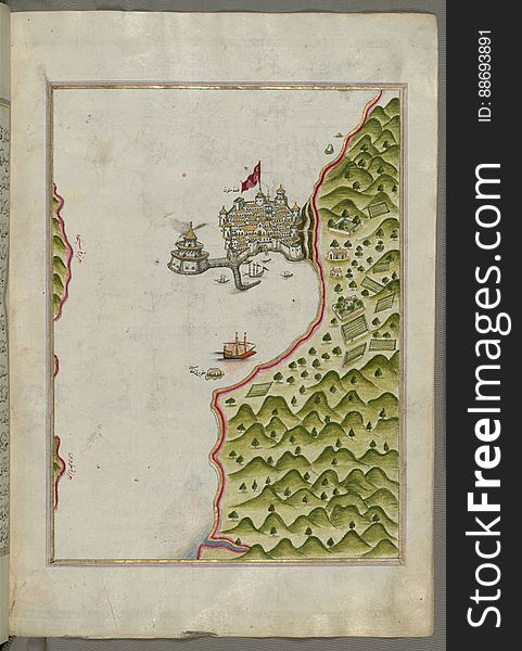
The Anatolian coast along the Kerme Bay from Book on Navigation, Walters Art Museum Ms. W.658, fol. 92a
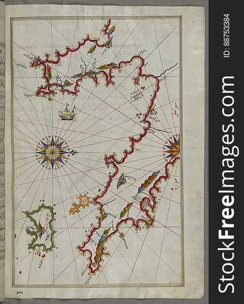
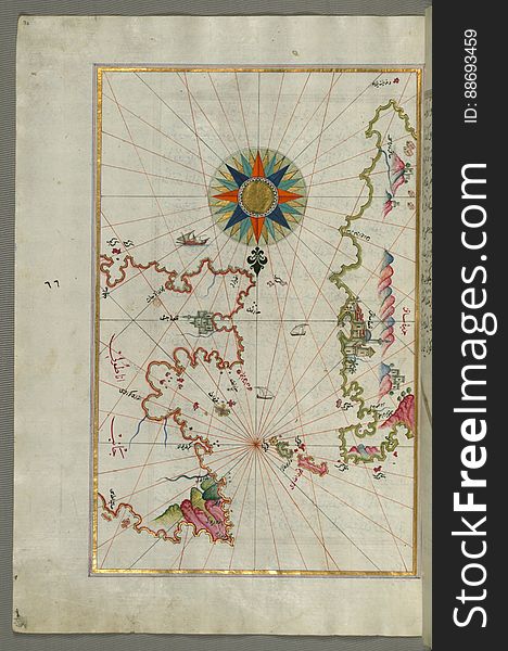
Illuminated Manuscript The Peloponnese (Morea, Mora) peninsula with the island of Kythira (Cerigo, Ҫoke) and
Terrestrial globe on black background
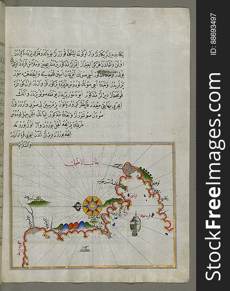
Chalkis (Herke) island off Rhodes Island from Book on Navigation, Walters Art Museum Ms. W.658, fol.104a
Male hand holding world globe crystal glass
Illuminated Manuscript Mykonos island in the Aegean Sea, from Book on Navigation, Walters Art Museum Ms. W.658, fol.116a
Creative Israel neon electric map. Shiny glowing outline of Israel country with text of ISRAEL
The island of Cos (Stancho, İstanköy) facing the Anatolian mainland from Book on Navigation, Walters Art Museum Ms. W.
Earth night map. Vector illustration of cities lights from space. Dark map
Illuminated Manuscript Tinos (İstendil) island in the Aegean Sea, from Book on Navigation, Walters Art Museum Ms. W.65
Nature background with world
Internet
Illuminated Manuscript Nisyros (Inǧirlü) island south of Cos (Stancho, İstanköy) island in the eastern Aeg
Little children, brothers, looking at illuminated globe, exploring
Abstract globe
Two small islands of the coast of Anatolia south of Samos (Ṣūṣām) and east of the city of Balat on the Anatolian s
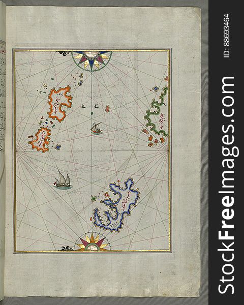
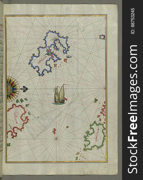
Several islands of the eastern Aegean Sea including: Leros (Līrūs) and Patmos (Bāṭnūz) from Book on Navi
Syme (Sömbeki) island north-west of Rhodes (Rodos) island from Book on Navigation, Walters Art Museum Ms. W.6
The Anatolian coast facing the island of Cos (Stancho, İstanköy) from Book on Navigation, Walters Art Museum Ms. W.658
Motion particle earth digital business concept
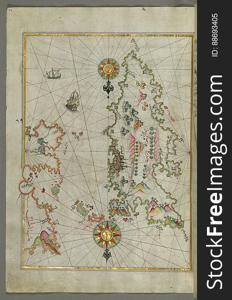
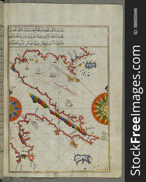
Detailed map of Chios (Sakiz, Ṣāqiz) Island with its fortress and other topographical features, from Book on Navigati
World globe cystal glass. Global business
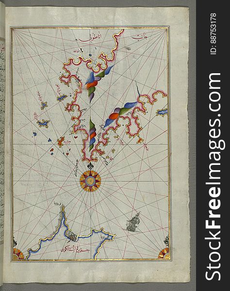
The island of Psara west of Chios, from Book on Navigation, Walters Art Museum Ms. W.658, fol.74a
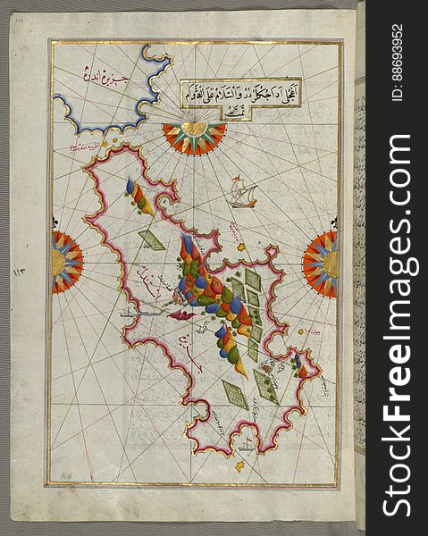
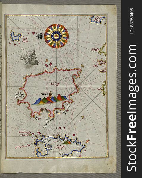
Rhodes (Rodos, Rudūs) Island from Book on Navigation, Walters Art Museum Ms. W.658, fol. 103a
High world technologies
Illuminated Manuscript The Methana (Mutūn) fortress in the Saronikos (Aiyina) Bay, from Book on Navigation, W
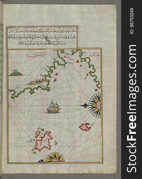
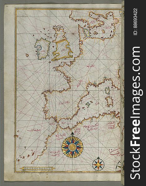
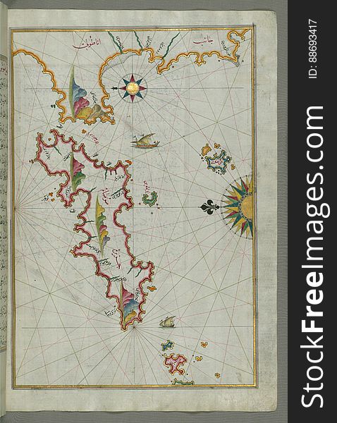
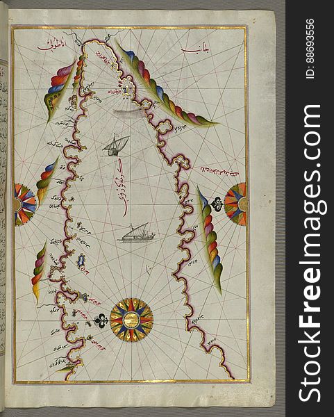
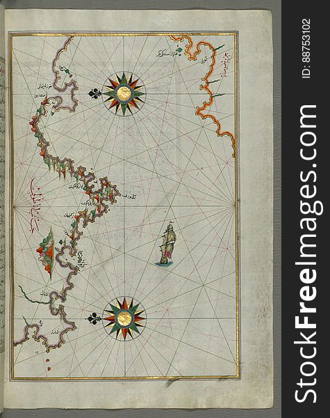
Map of western Europe and North Africa, from Book on Navigation, Walters Art Museum Ms. W.658, fol.64a
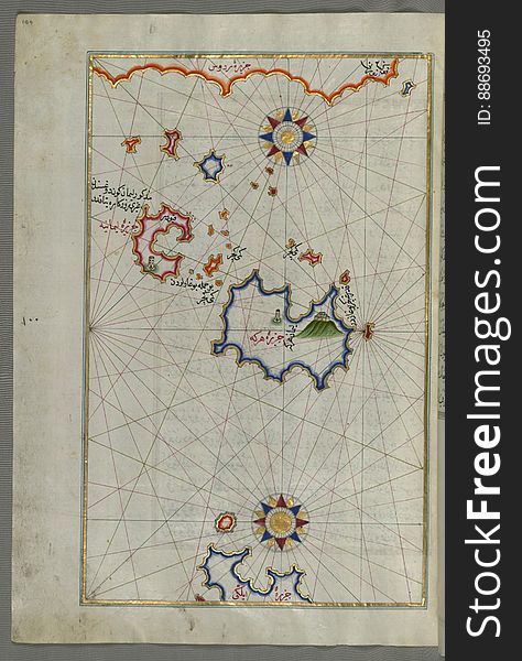
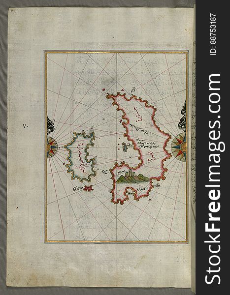
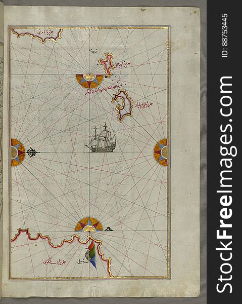
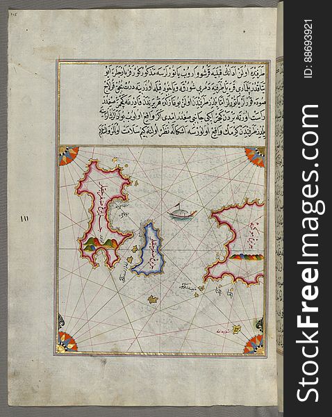
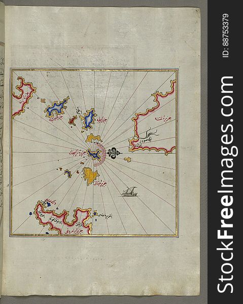
Illuminated Manuscript Two small islands between Amorgos (Yamurgi) and Cos (Stancho, İstanköy) in the easter
Visions with map and globe
Male hand holding world globe crystal glass
Earth night map. Vector illustration of cities lights from space. Dark globe map
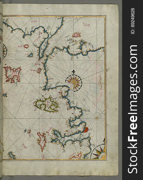
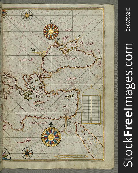
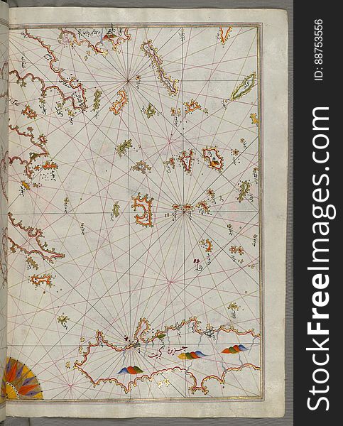
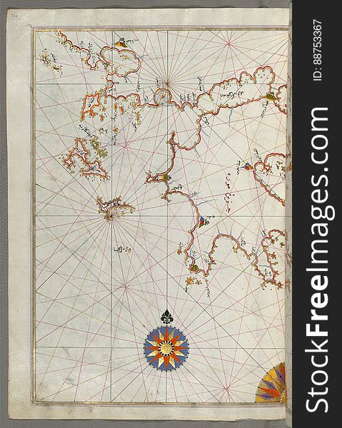
Map of the eastern Mediterranean, Aegean and the Black Sea, from Book on Navigation, Walters Art Museum Ms. W.658, fol.63b
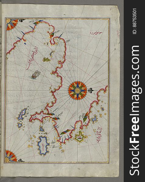
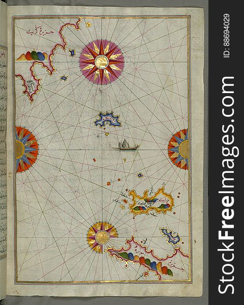
Illuminated Manuscript The Cyclades (Kikladhes) islands between the Peloponnese (Morea, Mora) peninsula and Cr
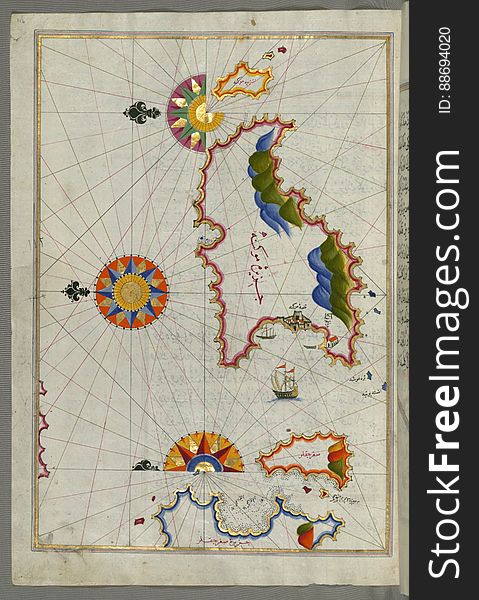
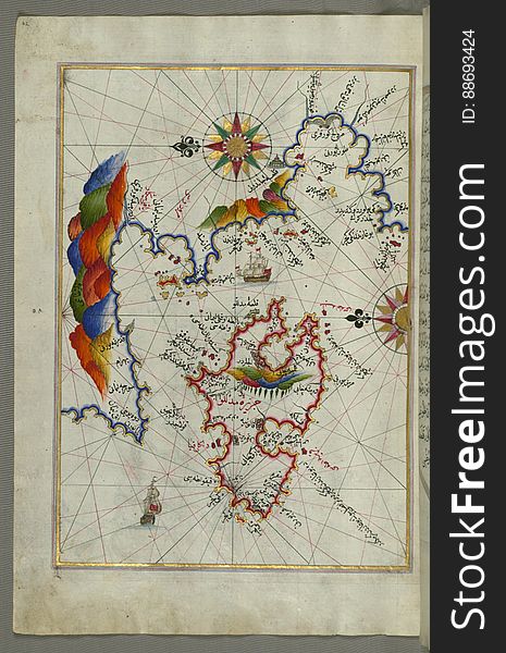
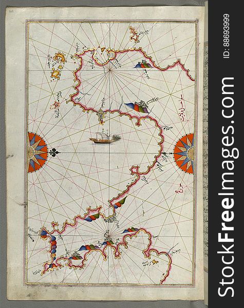
The Island of Samos, from Book on Navigation, Walters Art Museum Ms. W.658, fol.79b
The Bay of Kerme east of east of Cos (Stancho, İstanköy) island from Book on Navigation, Walters Art Museum Ms. W.658
Internet
Illuminated Manuscript, The island of Andros (Andre, Andra) in the northern Aegean Sea, from Book on Navigation, Walters
Little children, brothers, looking at illuminated globe, exploring
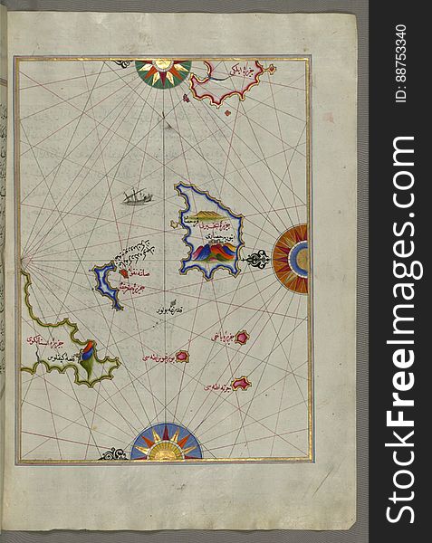
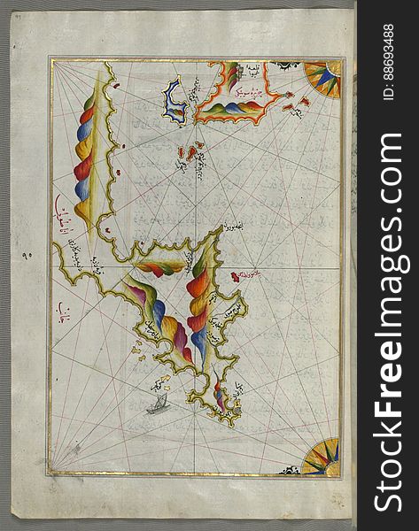
The Island of Kalimnos (Kalimaz) south of Leros in the eastern Aegean Sea from Book on Navigation, Walters Art Museum Ms
Illuminated Manuscript The islands of Delos and Rineia west of Mykonos island in the Aegean Sea, from Book on Navigation, Walters
Digital world
Illuminated Manuscript The Islands of Zakynthos (Zākīse), Kefalonia (Kefallinia, Kafālūnye) and Lefkada &
Chios (Sakiz, Sāqiz) Island facing Kysos (Çeşme) fortress on the Anatolian side, from Book on Navigation, W
Illuminated Manuscript Argolikos (Anaboli) Bay, from Book on Navigation, Walters Art Museum Ms. W.658, fol.122b
The Anatolian Coast facing Samos, from Book on Navigation, Walters Art Museum Ms. W.658, fol.75b
Illuminated Globe
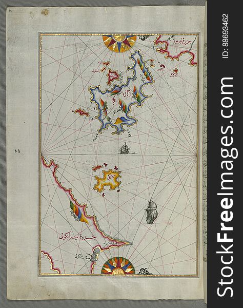
Illuminated Manuscript Small islands in the region of Naxos (Naḳşe) and Amorgos (Yamurgi) in the southeast
Illuminated Manuscript The island of Naxos (Naḳşe) in the southeastern Aegean Sea, from Book on Navigation, Walters
Anatolian coast and the small Kara (Qarah) island east of the town of Balat from Book on Navigation, Walters Art Museum
Motion earth digital globe particle surface zoom
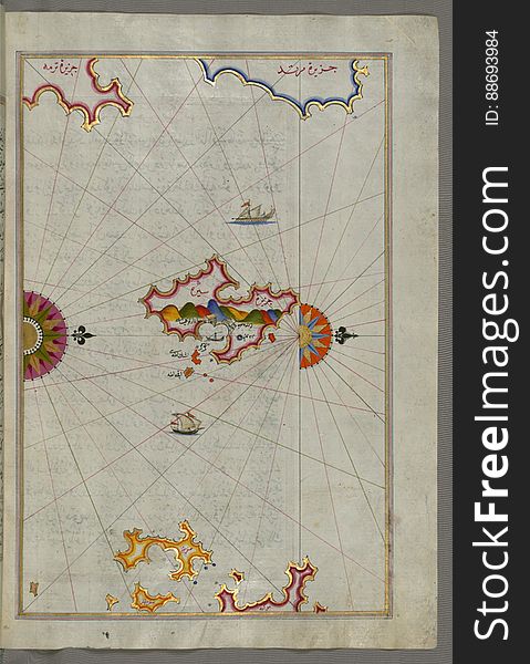
The island of Patmos (Bāṭnūz) south-east of Ikaria (Ahikere) in the eastern Aegean Sea from Book on Naviga
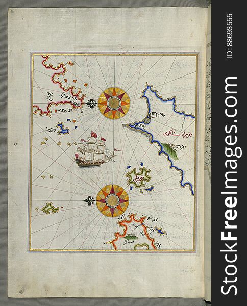
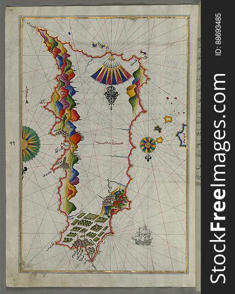
The Island of Midilli (Midillü, Mitylene, Lesvos) in the northeastern Aegean Sea, from Book on Navigation, Walters Art
Illuminated Manuscript The stretch of water between the Peloponnese (Morea, Mora) peninsula and the Island of Crete wit
Illuminated Manuscript Argolikos (Anaboli) Bay and Peloponnese (Morea, Mora) peninsula , from Book on Navigat
Earth digital globe transparent surface. 3D render
World background
Illuminated Manuscript Messiniakos Bay (Bay of Messini), fr, om Book on Navigation, Walters Art Museum Ms. W.658, fol.12
Illuminated Manuscript The island of Syros (Sire) in the Aegean Sea, from Book on Navigation, Walters Art Museum Ms. W.6
Traveling in an envelope
Next page
5
/ 6
Home
Search for Illuminated map world free images