Browse categories
Log in
Sign up
World Map Cities Free Stock Images
Safe search
Include:
RF-LL
Public Domain
Vector map of Honduras. High detailed country map with division, cities and capital Tegucigalpa. Political map, world map
Vector map of Wales. High detailed country map with division, cities and capital Cardiff. Political map, world map, infographic
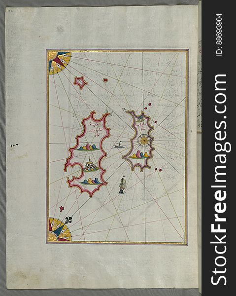
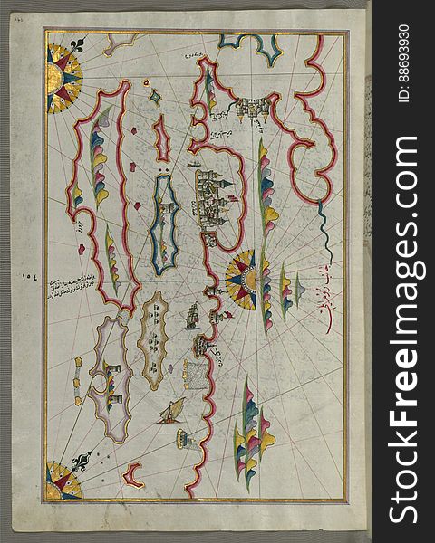
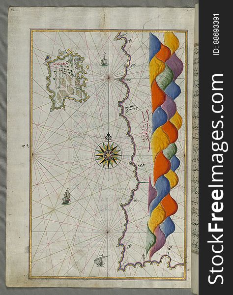
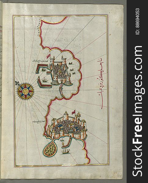
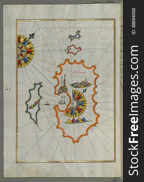
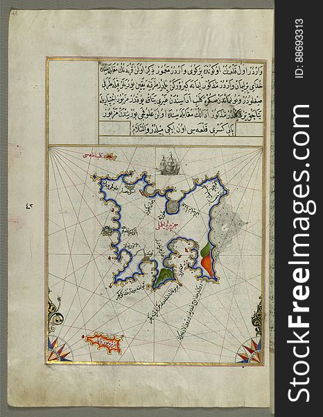
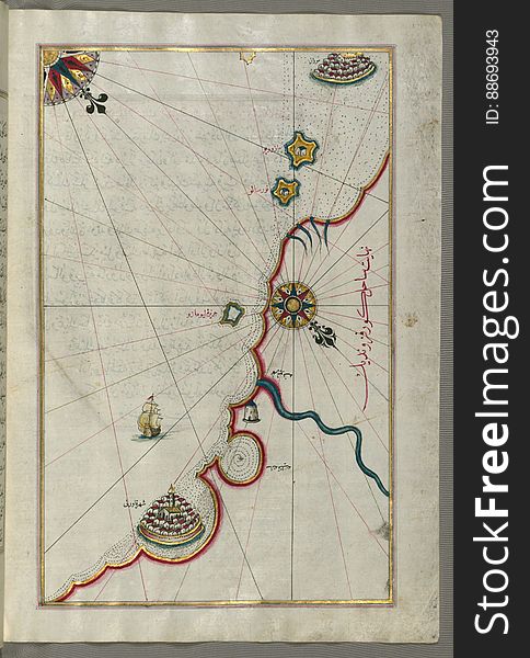
Illuminated Manuscript, Map of two as yet unidentified islands in the vicinity of Pag Island (Croatia) from Book on Nav
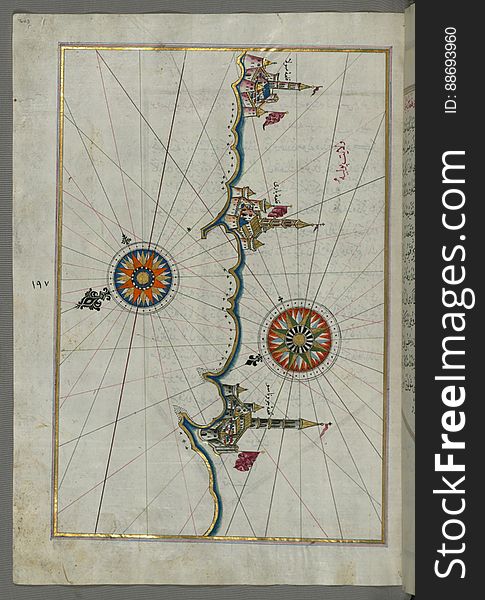
Illuminated Manuscript, Map of the coastline from Novi Grad as far as Umag (Umago, Ūmāghū) (Croatia) from B
Illuminated Manuscript, Map of the coastline from Poreč (Parenzo, Brānse) as far as Novi Grad (Croatia) from
Vector map of Congo. High detailed country map with division, cities and capital Brazzaville. Political map, world map
Illuminated Manuscript, Map of the coast of Andalusia from Valencia (Valense) to Cartagena (Qarte Cine) from B
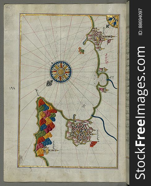
Illuminated Manuscript, Map of the coastline and the islands off Zadar (Zādare)(Croatia) from Book on Navigat
Illuminated Manuscript, Map of the Italian coastline from Pesaro (Pāzarū) south from Book on Navigation, Walters Art M
Illuminated Manuscript, Map of the Dalmatian Islands: Korčula (Qūrsūlah) and Lastovo (Augusta) off the coas
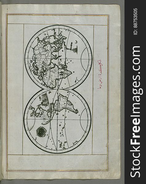
Illuminated Manuscript, World map in a double hemisphere, from Book on Navigation, Walters Art Museum Ms. W.658, fol. 40b
Vector map of Cape Verde. High detailed country map with division, cities and capital Praia. Political map, world map
Map of the world communication network. Vector low-poly image of a global map with lights in the form of cities
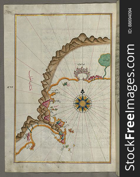
Illuminated Manuscript, Map of the fortress of Trieste (Rishtī) (Italy) from Book on Navigation, Walters Art
Illuminated Manuscript, Map of the Italian coast south of Ancona as far as the town of Pescara (Beshāre) from Book on N
Illuminated Manuscript, Map of the Southern part of the Calabrian peninsula and the straits of Messina (Mesīne) from Bo
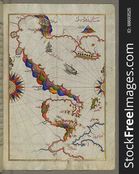
Illuminated Manuscript, Map of the western Italian coast as far as the city of Pisa (Pīze) from Book on Navigation, Wal
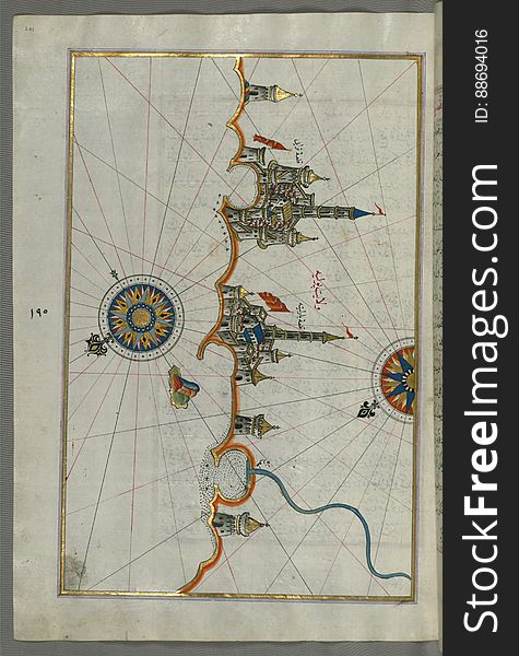
Illuminated Manuscript, Map of the Italian coastline south of Ancona including Tronto from Book on Navigation, Walters Art Museum
Vector map of Indonesia. High detailed country map with division, cities and capital Jakarta. Political map, world map
Vector map of Australia . High detailed map with division, cities and capital Canberra. Political map, world map, infographic
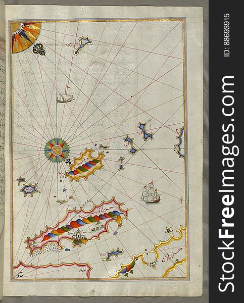
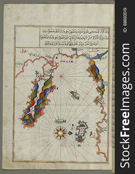
Illuminated Manuscript Map of the islands of Skyros (İskire) and Euboea (Evvoia, Aghrībūz, Eğriboz), from
Vector map of Argentina . High detailed country map with division, cities and capital Buenos Aires. Political map, world map
Vector map of Brazil. High detailed country map with division, cities and capital Brasilia. Political map, world map
Illuminated Manuscript, Map of the coastline from Muggia (Milje, Mūye) to Trieste (Rishtī) (Italy)
Illuminated Manuscript, Map of the Italian coastline from Rimini south towards Pesaro from Book on Navigation, Walters Art Museum
Illuminated Manuscript, Map of the straits of Messina and the western Italian coast from Book on Navigation, Walters Art Museum Ms
Illuminated Manuscript Map of part of the European coastline with the islands of Semendrek (Samothraki) and Imroz (
Vector map of Kyrgyzstan. High detailed country map with division, cities and capital Bishkek. Political map, world map
Illuminated Manuscript, Map of the western Italian coast as far as Naples (Pūlye Anāpūlīsī)and the island if Ischia
Illuminated Manuscript, Map of the Italian coast between Termoli and Peschici from Book on Navigation, Walters Art Museum Ms. W.65
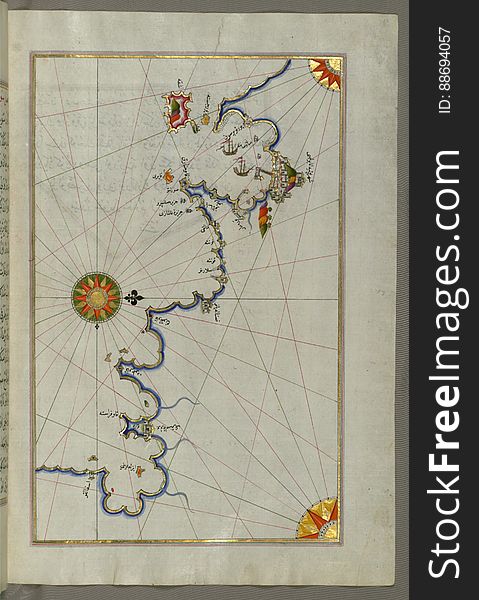
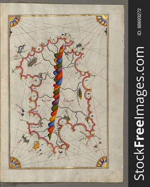
Illuminated Manuscript Map of The island of Bozjah (Tenedos) off the coast of Anatolia, from Book on Navigation, Walters
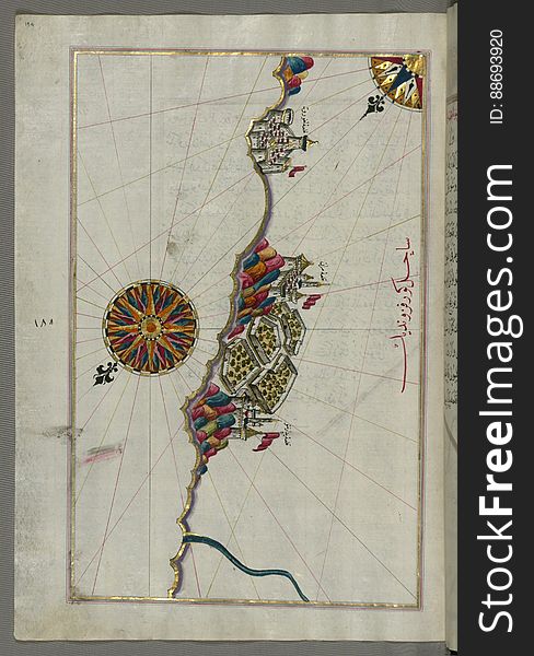
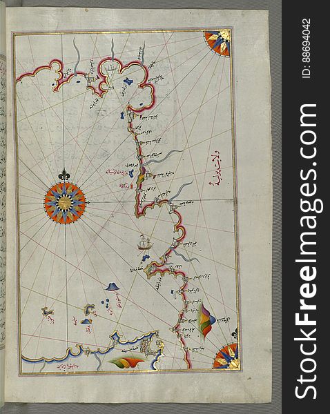
Illuminated Manuscript, Map of the Anatolian coast from Alanya (ʿAlāʾiye Alaiye) to Andalye (Antalya, formerly k
Vector map of China. High detailed country map with division, cities and capital Beijing. Political map, world map, infographic
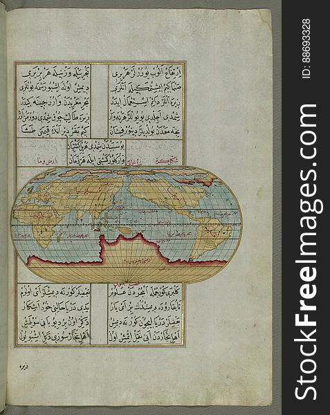
Illuminated Manuscript Map of the World from Book on Navigation, Walters Art Museum Ms. W.658, fol. 41a
Vector map of Latvia. High detailed country map with division, cities and capital Riga. Political map, world map, infographic
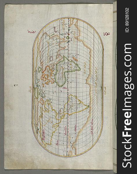
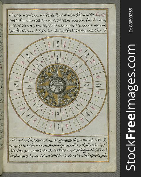
Illuminated Manuscript, Oval Map of the World, from Book on Navigation, Walters Art Museum Ms. W.658, fol.23b
Illuminated Manuscript, Map of the coastline from Izola (Īzele) as far as Koper (Capodistria, Dishtriye) 
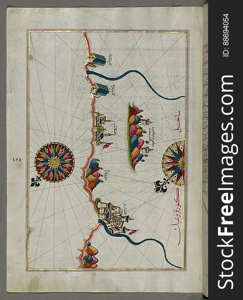
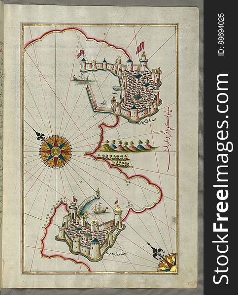
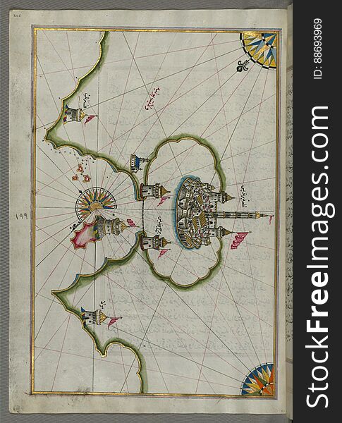
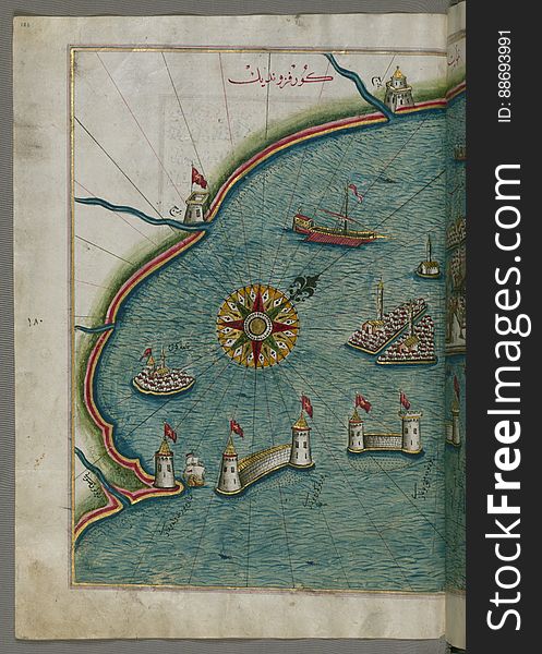
Illuminated Manuscript, Map of the port of Brindisi (Parindīs) from Book on Navigation, Walters Art Museum Ms. W.658, f
Vector map of Malaysia. Country map with division, cities and capital Kuala Lumpur. Political map, world map, infographic
Illuminated Manuscript, Map of the coastline from Piran (Pirānū) as far as Izola (Īzele) (Slovenia
Vector map of Azerbaijan . High detailed country map with division, cities and capital Baku. Political map, world map
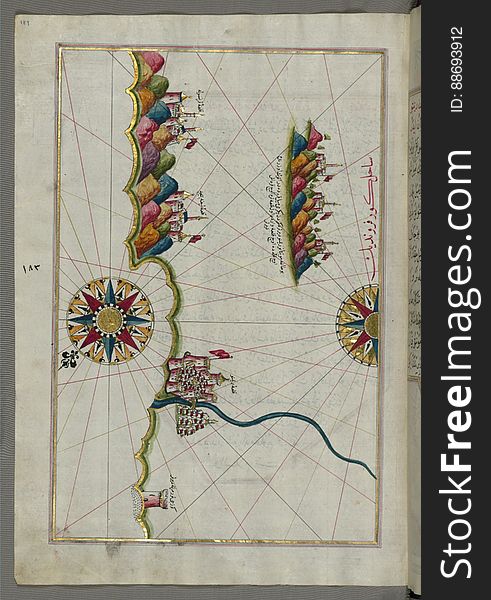
Illuminated Manuscript, Map of the coastline from Mafredonia as far as Barletta on the Italian coast from Book on Navigation, Walt
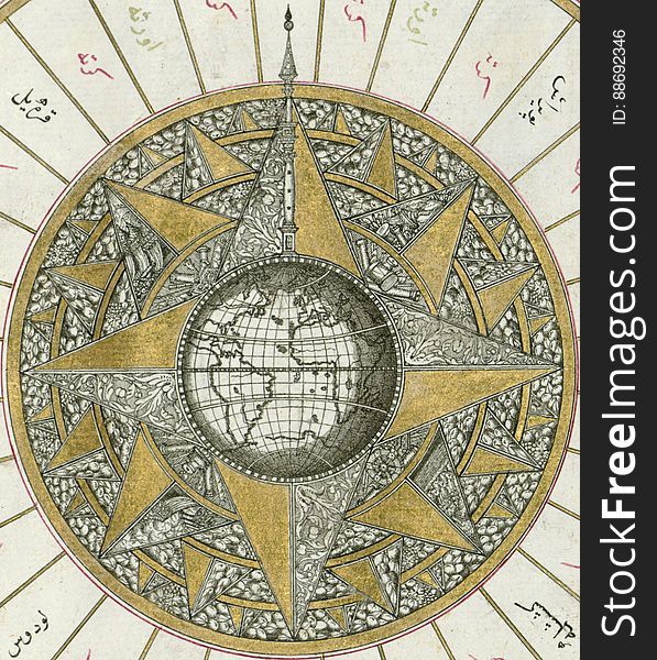
Illuminated Manuscript, Map of Western hemisphere within a windrose, from Book on Navigation, Walters Art Museum Ms. W.658, fol.24
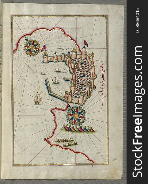
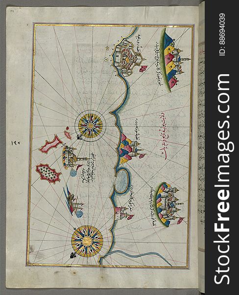
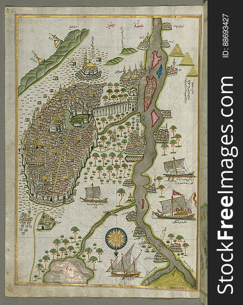
Illuminated Manuscript Map of Cairo, from Book on Navigation, Walters Ms. W.658, fol. 305b
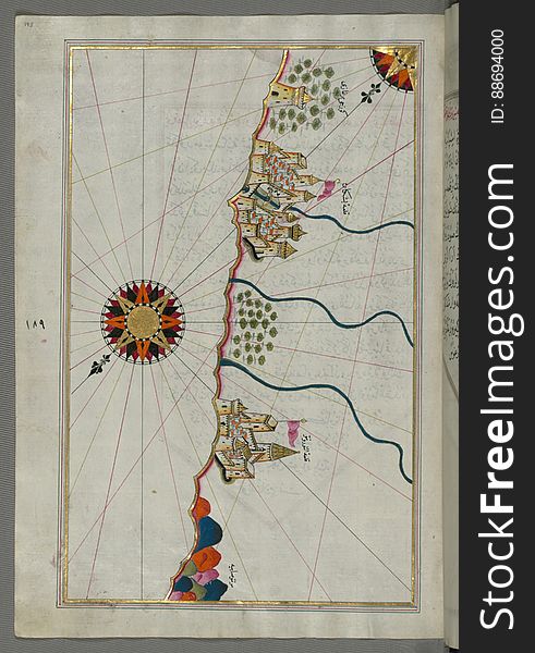
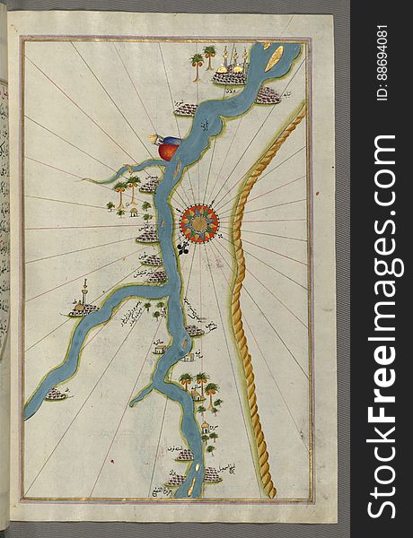
Illuminated Manuscript, Map of towns and oasis along the river Nile beginning with Būlāq (south of Cairo) from Book on
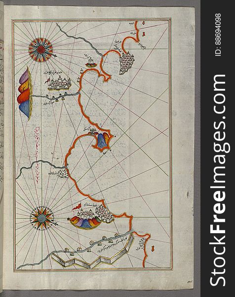
Illuminated Manuscript, Map of the Algerian coast around Ora from Melilla (Malīlah) and northwest of Tlemcen (Tili
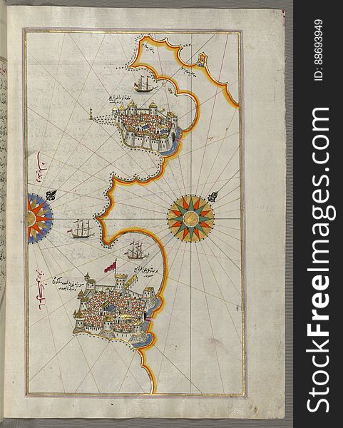
Illuminated Manuscript, Map of the town of Bari and the surrounding area from Book on Navigation, Walters Art Museum Ms. W.658, fo
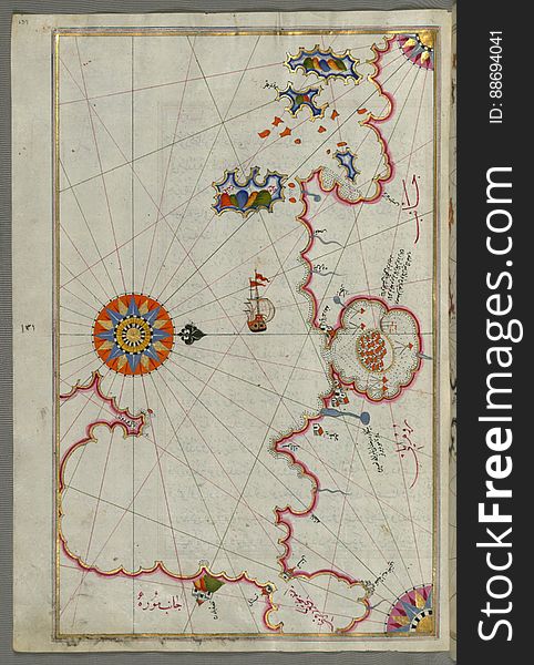
Illuminated Manuscript, Map of Premuda (Premūde Venedīk) island west off the Pag Island (Croatia) from Book
Illuminated Manuscript Map of the area west of the island of Thasos (Taşöz) and the Ayion Oros Peninsula, from Book on
Vector map of Colombia. High detailed country map with division, cities and capital Bogota. Political map, world map, infographic
Illuminated Manuscript, Map of Western hemisphere within a windrose, from Book on Navigation, Walters Art Museum Ms. W.658, fol.24
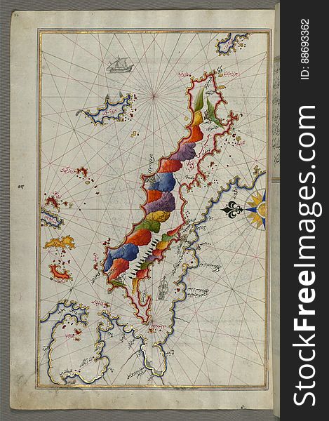
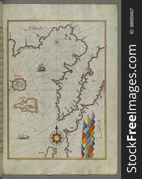
Illuminated Manuscript Map of the island of Lemnos, from Book on Navigation, Walters Art Museum Ms. W.658, fol.47a
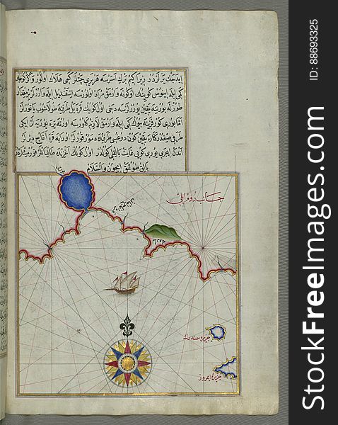
Illuminated Manuscript, Map of The Bay of Corinth from Book on Navigation, Walters Art Museum Ms. W.658, fol.137a
Illuminated Manuscript Map of Sardina from Book of Navigation, Walters Art Museum, Ms. W.658, fol. 226b
Illuminated Manuscript Map of The Islands of Semendrek (Samothraki) and Imroz (Imbros) in the Aegean Sea, from
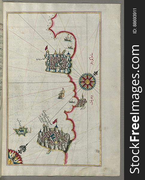
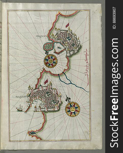
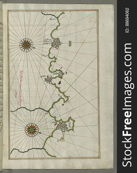
Illuminated Manuscript, Map of the Italian coastline from Barletta to Trani from Book on Navigation, Walters Art Museum Ms. W.658
Illuminated Manuscript, Map of the western part of the city of Venice (Venedīk) from Book on Navigation, Walters Art Mu
Illuminated Manuscript, Map of the Algerian coast around Algiers (Jazāʾir) from Book on Navigation, Walters Art Museum
Illuminated Manuscript Map of the Bay of Salonica (Selānīk,Thessalonici) and the western coastline, from Book on Navig
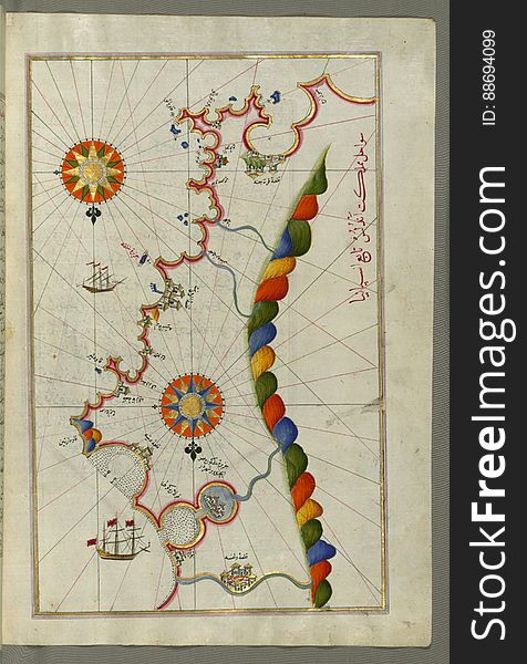
Illuminated Manuscript, Map of the coastline from Marano (Mūrān) to Caorle (Qāvarlī), Province of Venice f
Next page
3
/ 11
Home
Search for World map cities free images