Free Stock Images from Marcel Miz (Ikelius)
-

Digital Elevation Model Of A Mine With Steep Walls
-

Digital Topographic Elevation Model Of A Excavation Site With Steep Walls
-

Digital Topographic Elevation Model Of A Excavation Hole With Steep Walls
-

Digital Elevation Model Of A Road Junction In City
-

Outline Map Of Italy With The National Flag
-

Map Of Elevation Of A City Urban Area With Roads And Junctions For GIS And Planning Usage
-

Digital Elevation Model Of A Construction Site
-

Digital Elevation Model Of A Quarry For GIS Usage
-

Digital Elevation Model Of A Mine Machinery
-

One Hundred Zlotys. Polish Bank Note
-

Outline Map Of Canada With The National Flag
-

Digital Elevation Model Of A Fields And Meadows
-

Seashell With Red Cross, Symbol Of Santiago De Compostela
-

Map Of A Mountain Peaks And Tops With Coloured Geospatial Data For GIS Usage
-

Map Of Elevation Of A City Urban Area With Roads And Junctions For GIS And Planning Usage
-

Digital Elevation Model Of An Urban Area
-

GIS Product Made After Proccesing Aerial Pictures Taken From A Drone. High Rocky And Steep Mountain Peaks
-

Seashell With Red Cross, Symbol Of Santiago De Compostela
-

Digital Elevation Model Of An Urban Area
-

Digital Elevation Model Of A Fields And Meadows
-

Map Of Elevation Of A City Urban Area With Roads And Junctions For GIS And Planning Usage
-

Topographic Relief
-

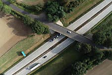
Two Lane Highway With Cars Visible, Top Down Aerial View
-

Map Of Elevation Of A City Urban Area With Roads And Junctions For GIS And Planning Usage
-

Digital Elevation Model Of A Mine With Steep Walls
-

Digital Elevation Model Of A Quarry
-

Digital Elevation Model Of Mine For GIS Usage
-

Map Of Elevation Of A City Urban Area With Roads And Junctions For GIS And Planning Usage
-

Elevation Scan Of A Forest Area With A Meandering River


