Browse categories
Log in
Sign up
Proceeds Free Stock Images
Safe search
Include:
RF-LL
Public Domain
Sponsored images by
Dreamstime
Time is money
A bumpy divorce.
Estate Planning
Social Media Marketing
Money Handshake America Business
Time Money Business Management Dollars
Money Business Time Superannuation Management
Australian Superannuation Time Money Management Retirement
Ebusiness
Money Tree
Piggy Bank
E-Business
E-Business
Actor Alan Thicke
Note spike with receipts on it
Bundle of US dollars banknotes on over white
Homeless man asking for money
Queen a glass chess piece
Green Young plant with money. Vector
Little mouse and cheese
Money composition.
A lot of banknotes one US dollars
A lot of banknotes one US dollars
Jacks Canyon Trail No. 55
Jacks Canyon Trail No. 55
Jacks Canyon Trail No. 55
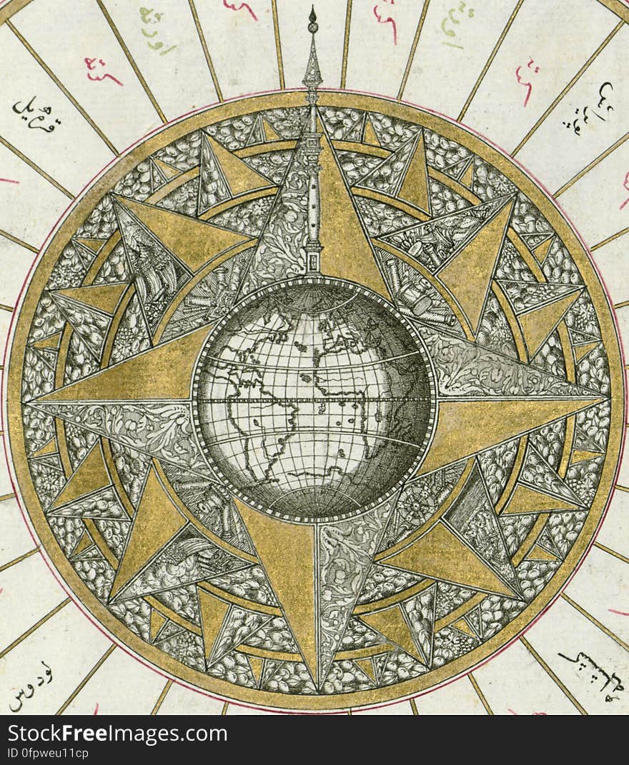
Illuminated Manuscript, Map of Western hemisphere within a windrose, from Book on Navigation, Walters Art Museum Ms. W.658, fol.24
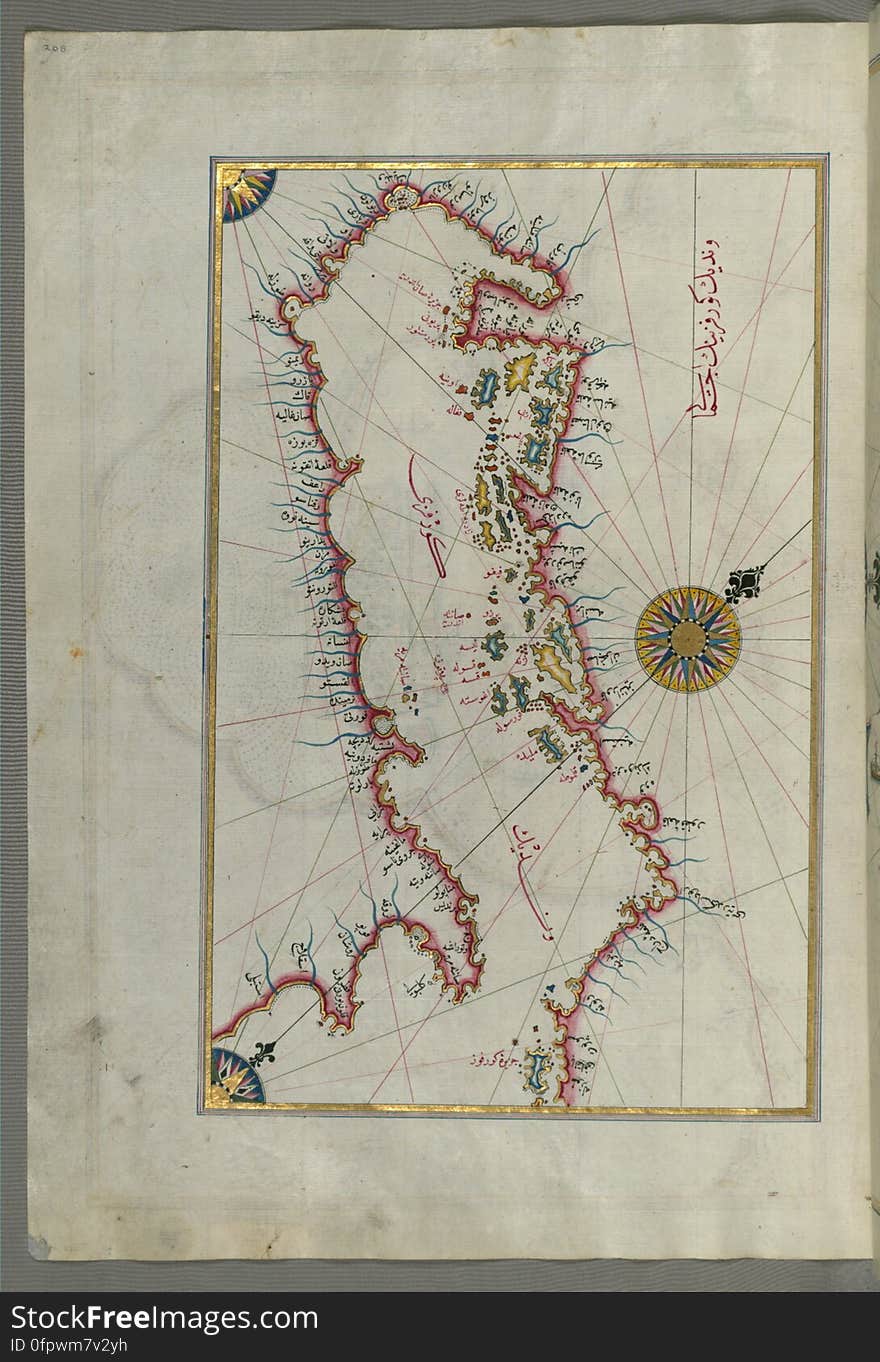
Illuminated Manuscript Map of the Islands of the Adriatic Coast from Book on Navigation, Walters Art Museum Ms. W.658, fol. 208a
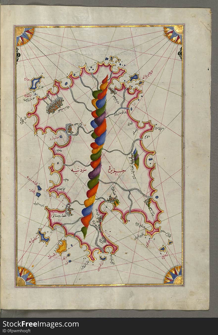
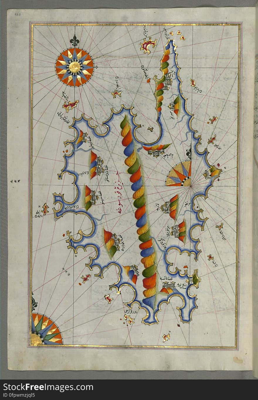
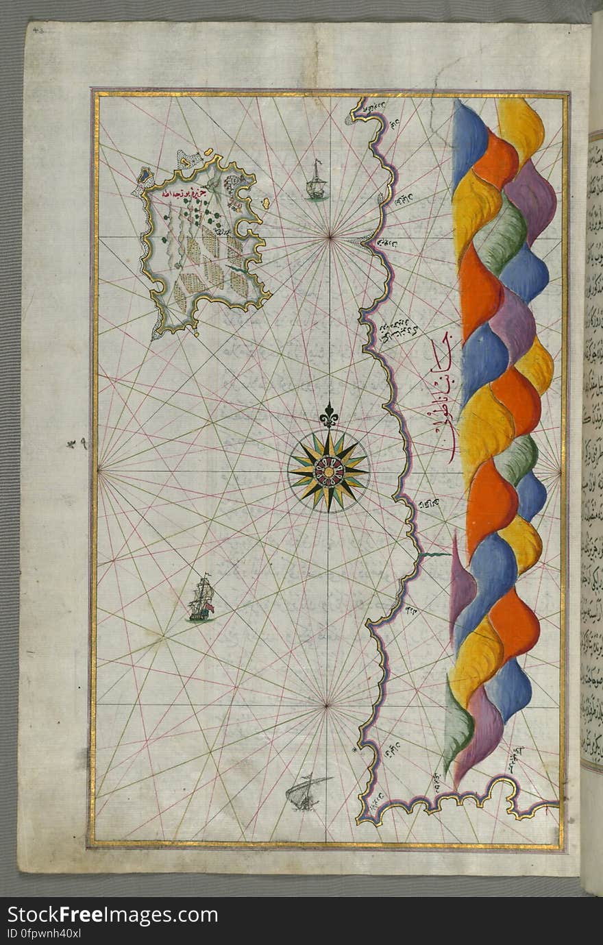
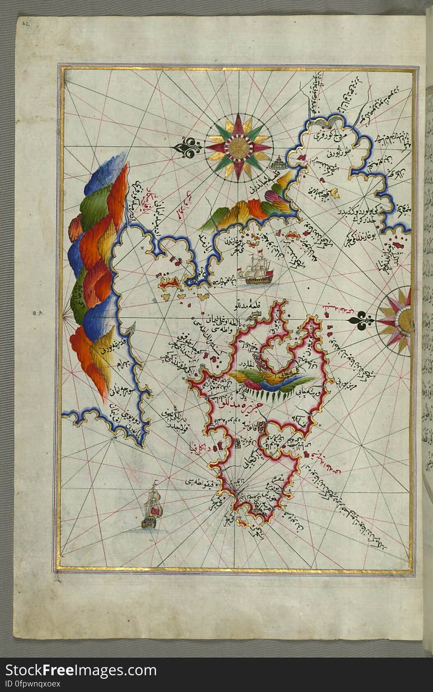
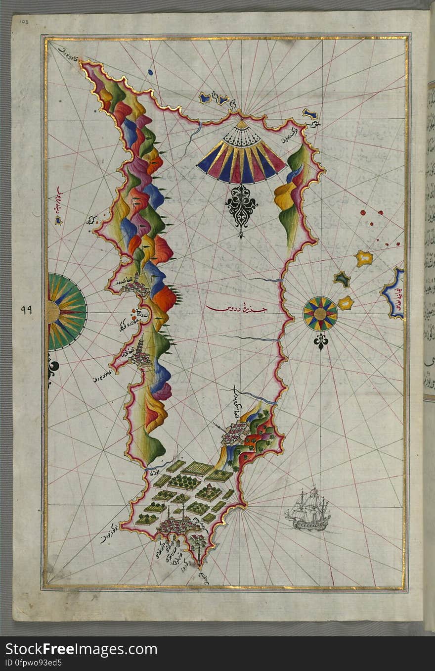
Illuminated Manuscript Map of Sardina from Book of Navigation, Walters Art Museum, Ms. W.658, fol. 226b
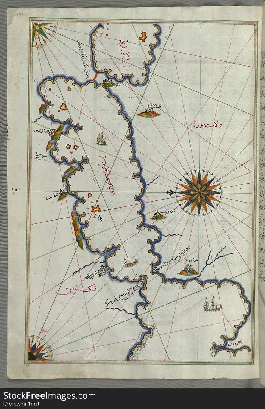
Illuminated Manuscript Map of Saronikos (Aiyina) Bay, from Book on Navigation, Walters Art Museum Ms. W.658, fol. 133a
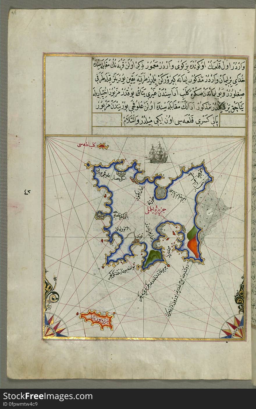
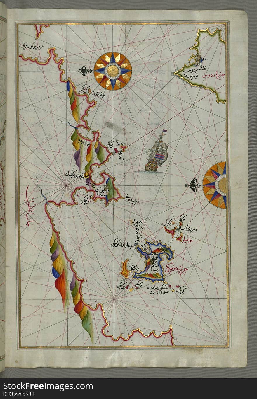
Illuminated Manuscript Map of the island of Lemnos, from Book on Navigation, Walters Art Museum Ms. W.658, fol.47a
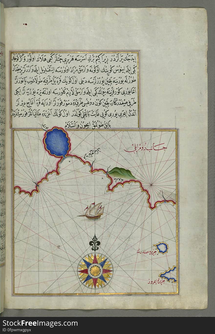
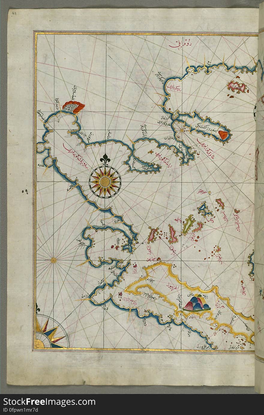
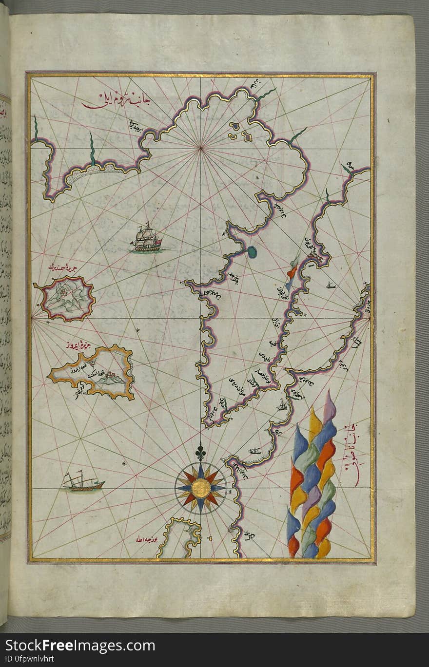
Illuminated Manuscript Map of part of the European coastline with the islands of Semendrek (Samothraki) and Imroz (
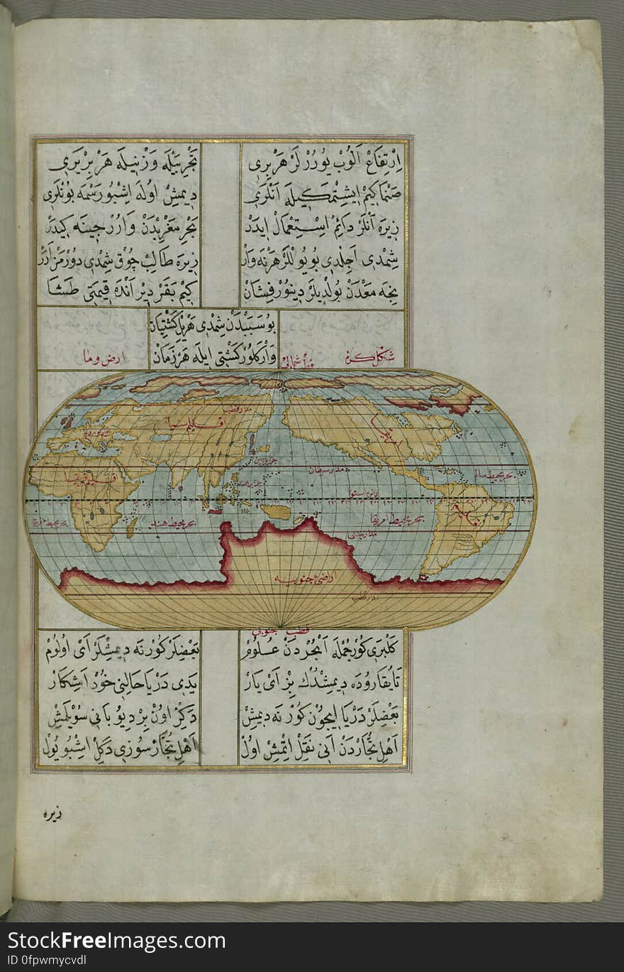
Illuminated Manuscript, Oval Map of the World, from Book on Navigation, Walters Art Museum Ms. W.658, fol.23b
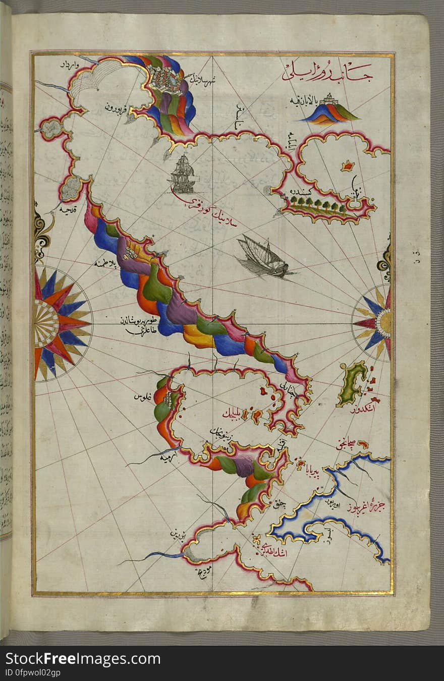
Illuminated manuscript Map of Corsica, from Book on Navigation, Walters Art Museum Ms. 658, fol. 229a
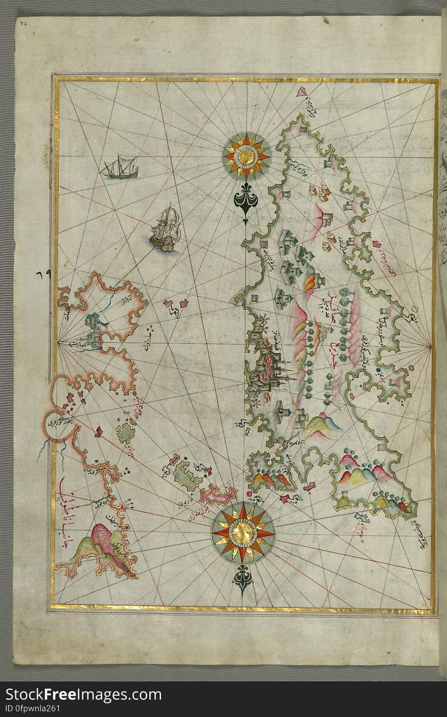
The coastline of the western Aegean Sea as far south as the Island of Euboea (Evvoia, Aghrībūz, Eğriboz), from Book o
Illuminated Manuscript, Map of Western hemisphere within a windrose, from Book on Navigation, Walters Art Museum Ms. W.658, fol.24
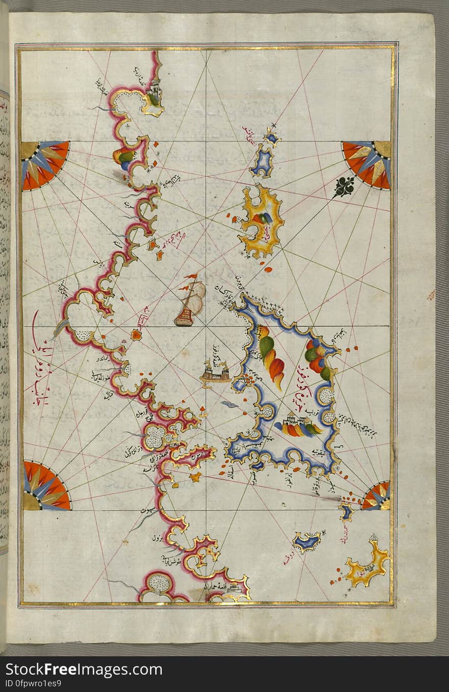
Illuminated Manuscript Map of the islands of Skyros (İskire) and Euboea (Evvoia, Aghrībūz, Eğriboz), from
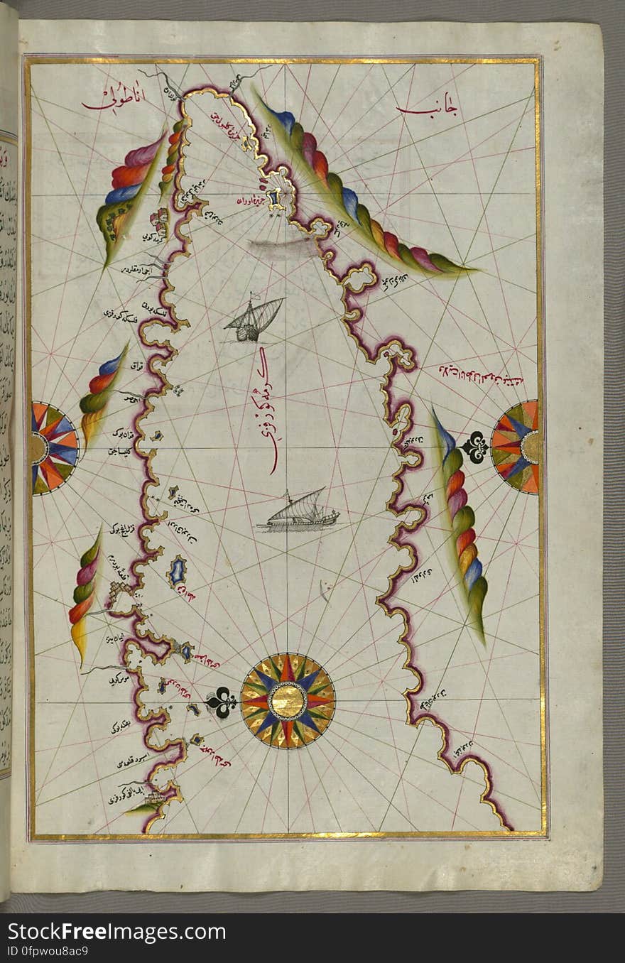
Illuminated Manuscript map of the northeastern tip of Rhodes (Rodos, Rūdūs) Island facing the Anatolian coast with the
Illuminated Manuscript Map of The island of Bozjah (Tenedos) off the coast of Anatolia, from Book on Navigation, Walters
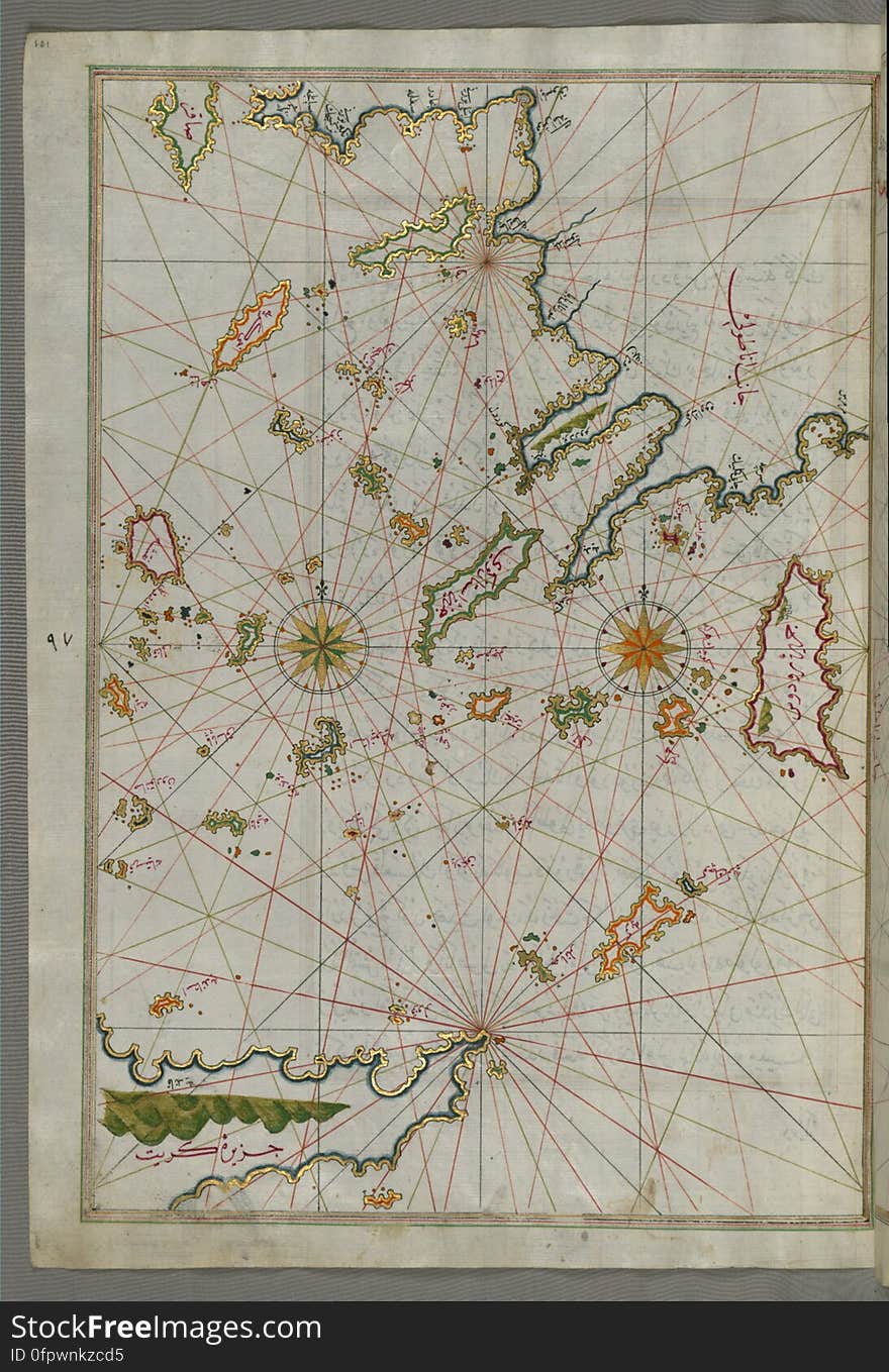
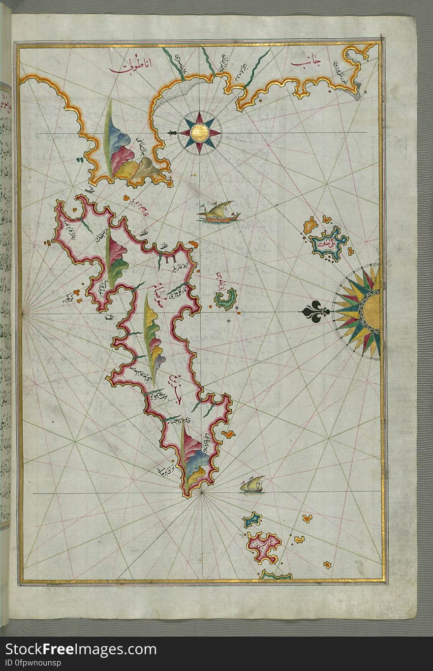
Illuminated Manuscript map of the islands of the Aegean Sea including Chios (Sakiz), Cos (Stancho, İstanköy)
Detailed map of Chios (Sakiz, Ṣāqiz) Island with its fortress and other topographical features, from Book on Navigati
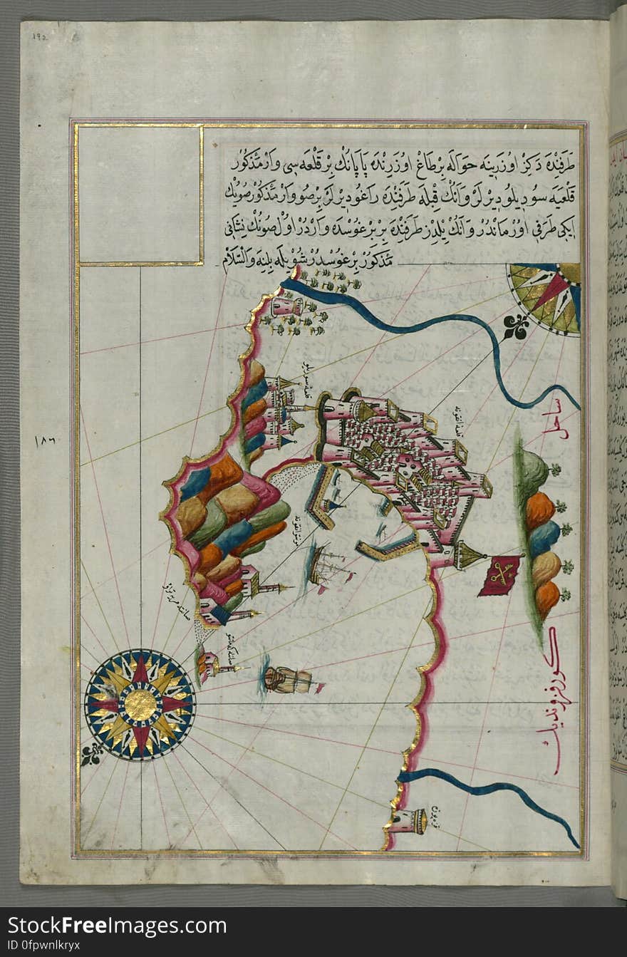
Illuminated manuscript Map of the Fortress of Ancona, from Book on navigation, Walters Art Museum ms. W.658, fol. 192a
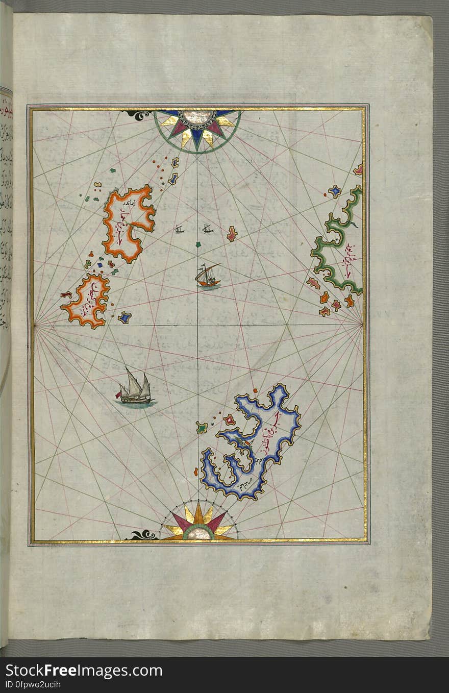
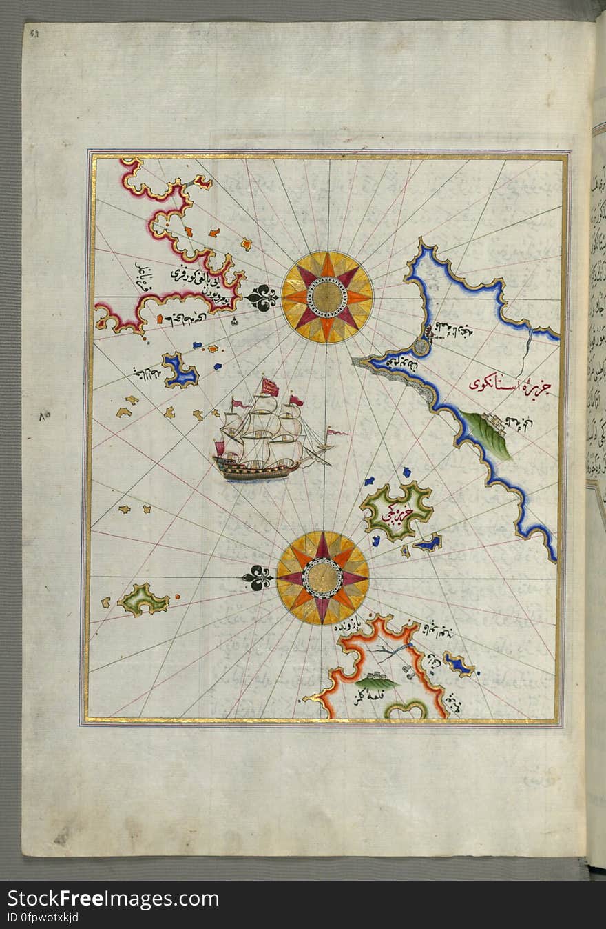
Illuminated Manuscript Map of The Islands of Semendrek (Samothraki) and Imroz (Imbros) in the Aegean Sea, from
The Island of Samos, from Book on Navigation, Walters Art Museum Ms. W.658, fol.79b
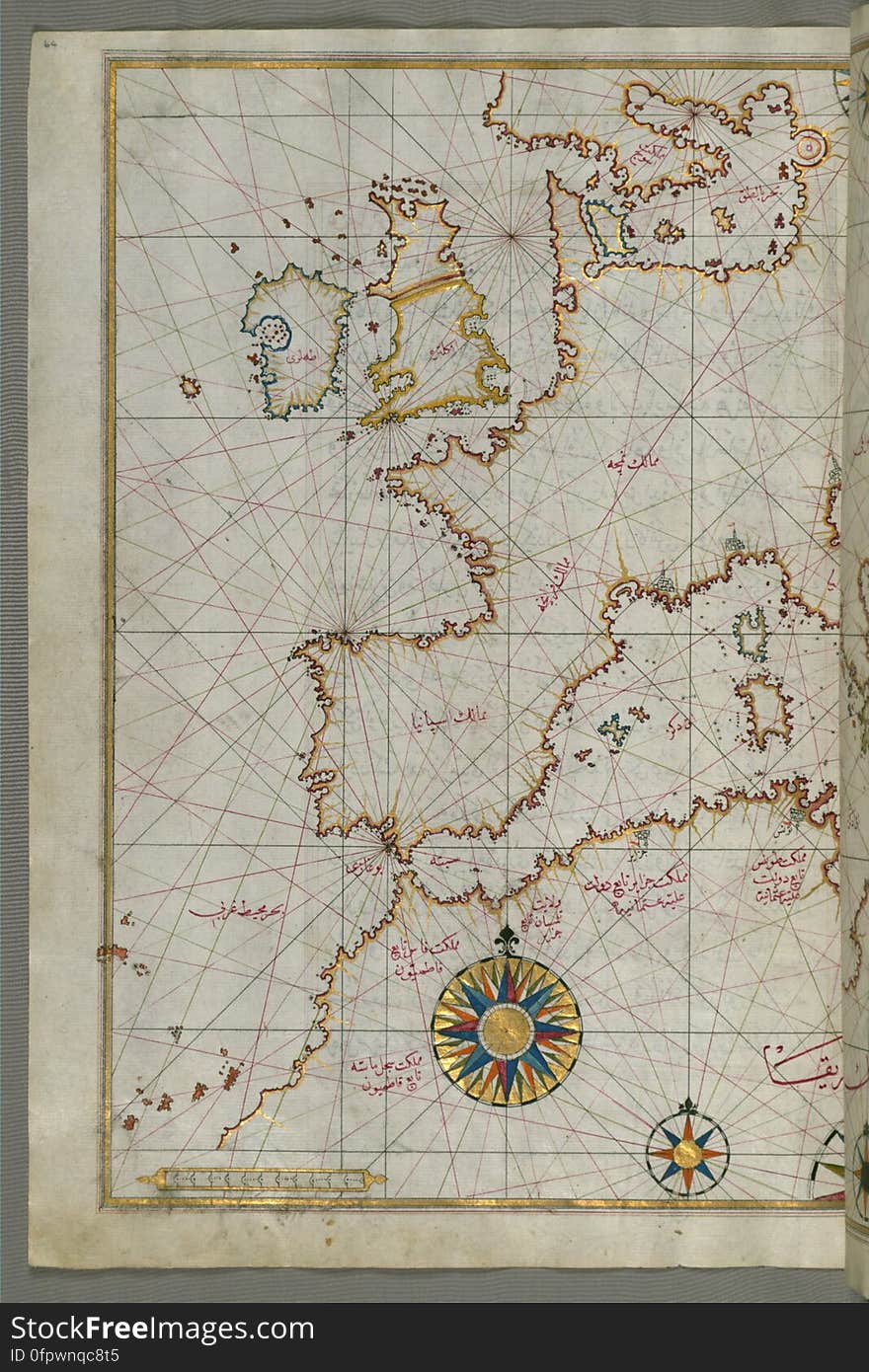
Map of western Europe and North Africa, from Book on Navigation, Walters Art Museum Ms. W.658, fol.64a
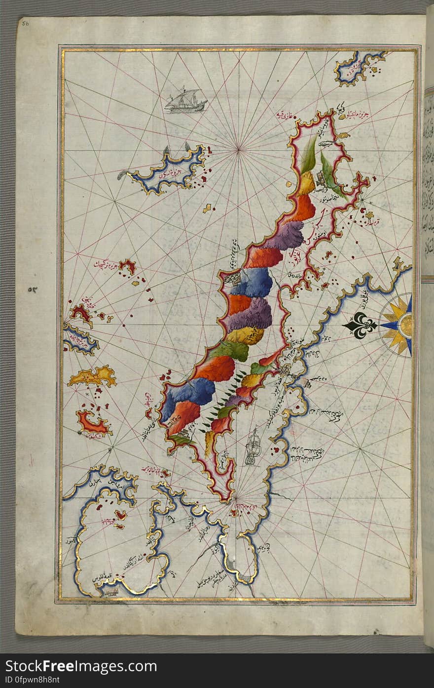
The Island of Midilli (Midillü, Mitylene, Lesvos) in the northeastern Aegean Sea, from Book on Navigation, Walters Art
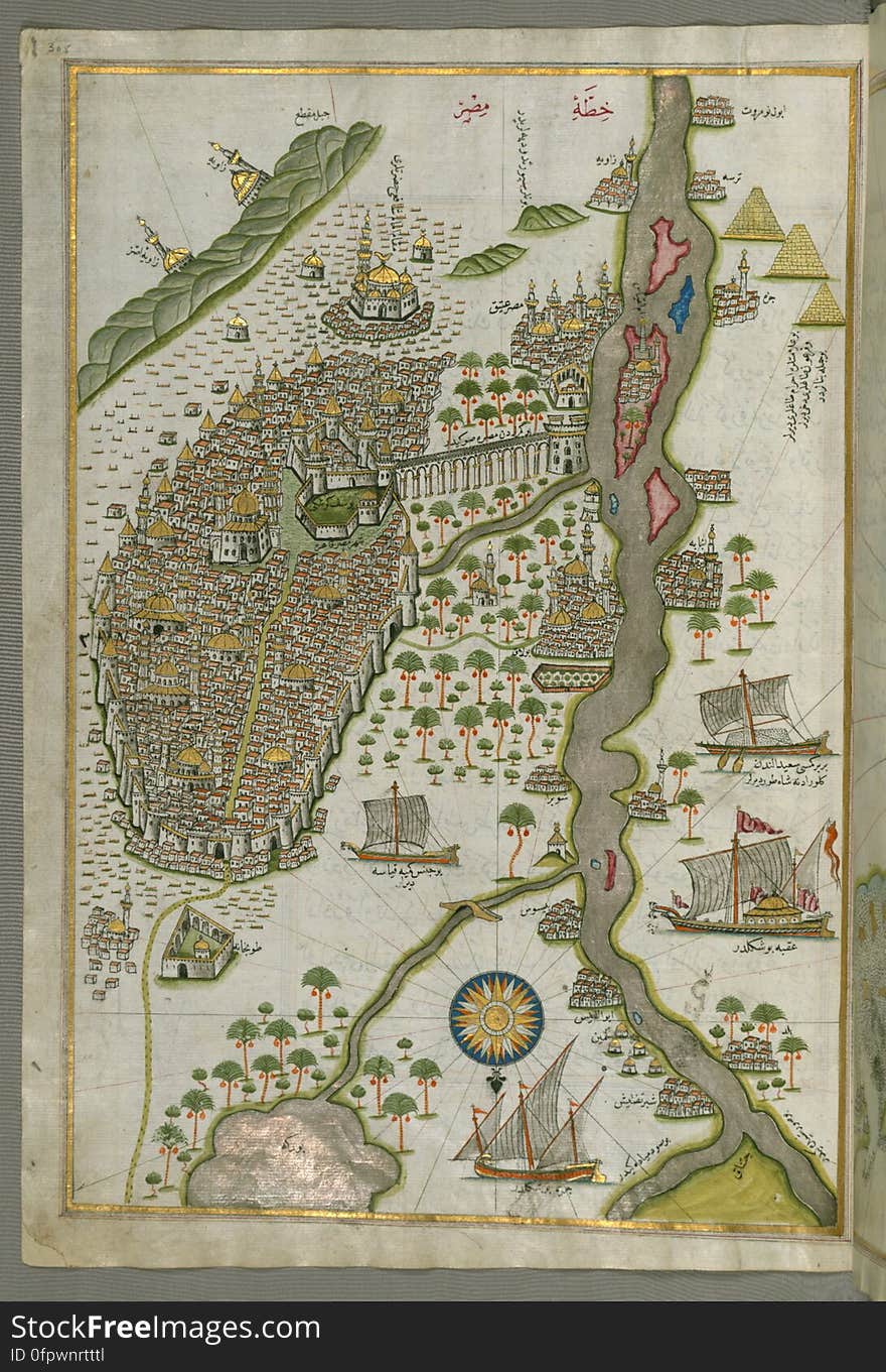
Illuminated Manuscript Map of Cairo, from Book on Navigation, Walters Ms. W.658, fol. 305b
Chios (Sakiz, Sāqiz) Island facing Kysos (Çeşme) fortress on the Anatolian side, from Book on Navigation, W
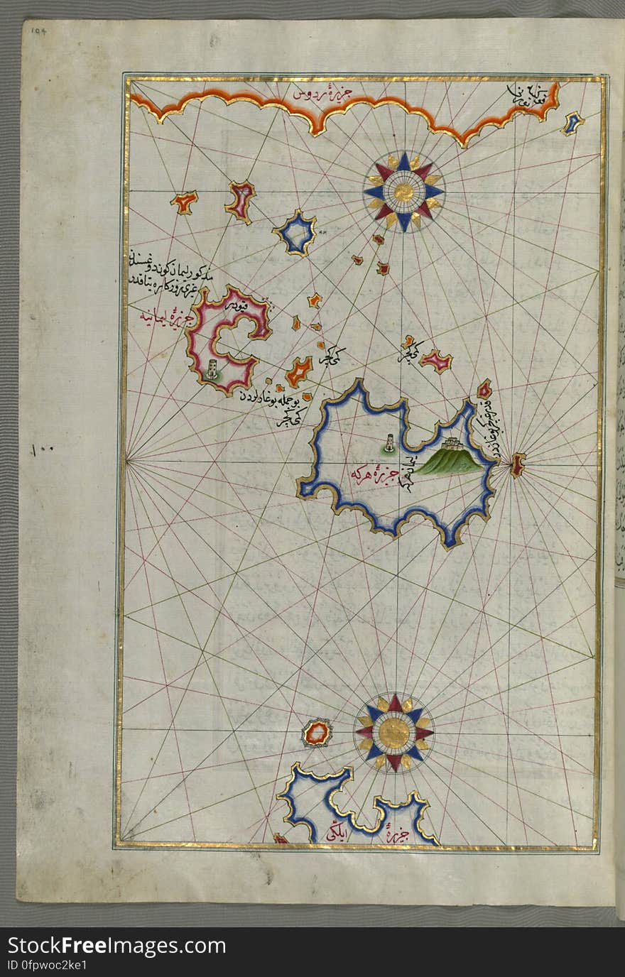
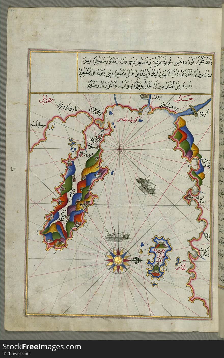
The Island of Kalimnos (Kalimaz) south of Leros in the eastern Aegean Sea from Book on Navigation, Walters Art Museum Ms
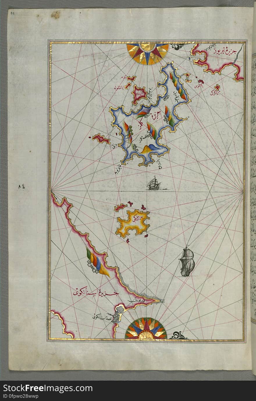
Several islands of the eastern Aegean Sea including: Leros (Līrūs) and Patmos (Bāṭnūz) from Book on Navi
Illuminated Manuscript Map of the coast of Andalusia with the city of Grenada (Gharnātah), from Book on Navigation, Wal
Rhodes (Rodos, Rudūs) Island from Book on Navigation, Walters Art Museum Ms. W.658, fol. 103a
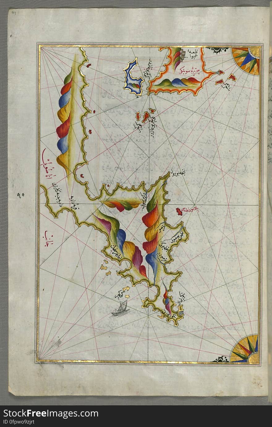
Syme (Sömbeki) island north-west of Rhodes (Rodos) island from Book on Navigation, Walters Art Museum Ms. W.6
Chalkis (Herke) island off Rhodes Island from Book on Navigation, Walters Art Museum Ms. W.658, fol.104a
Anatolian coast and the small Kara (Qarah) island east of the town of Balat from Book on Navigation, Walters Art Museum
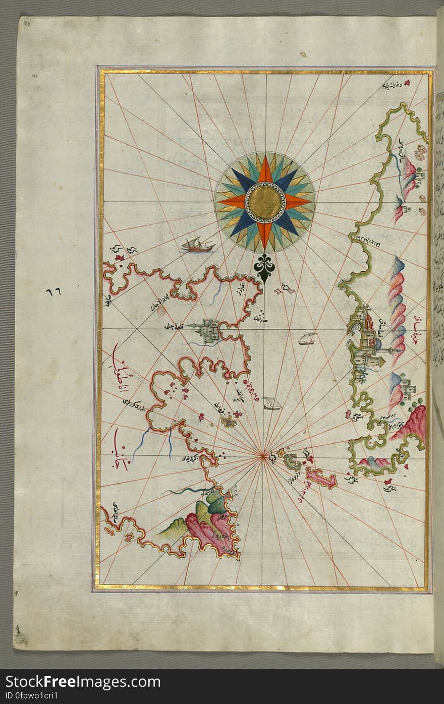
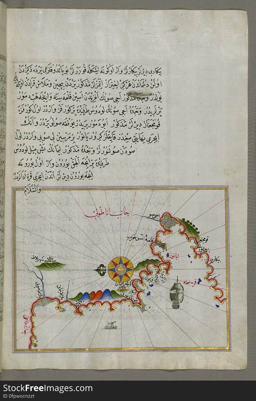
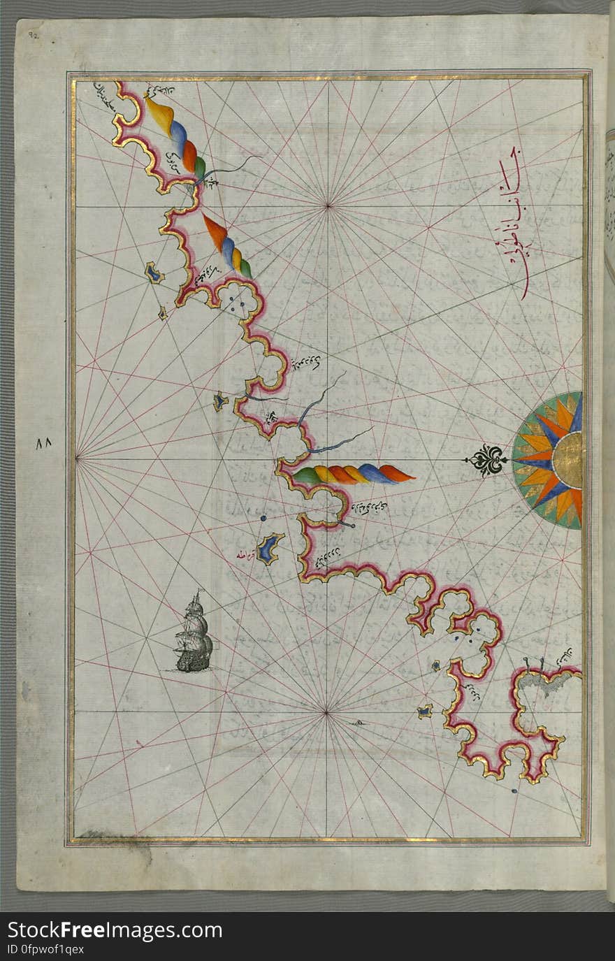
The Anatolian coast along the Kerme Bay from Book on Navigation, Walters Art Museum Ms. W.658, fol. 92a
Illuminated Manuscript Map of the area west of the island of Thasos (Taşöz) and the Ayion Oros Peninsula, from Book on
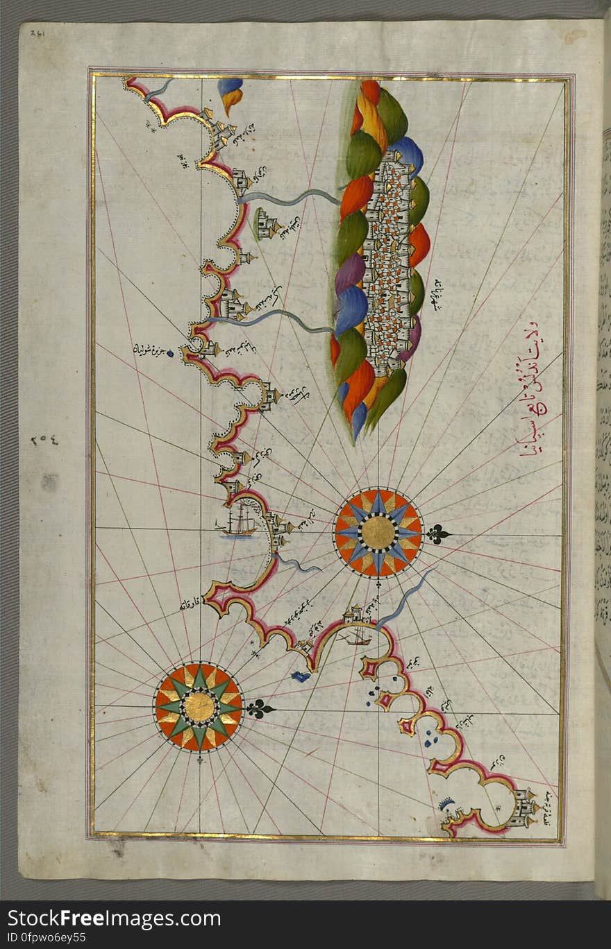
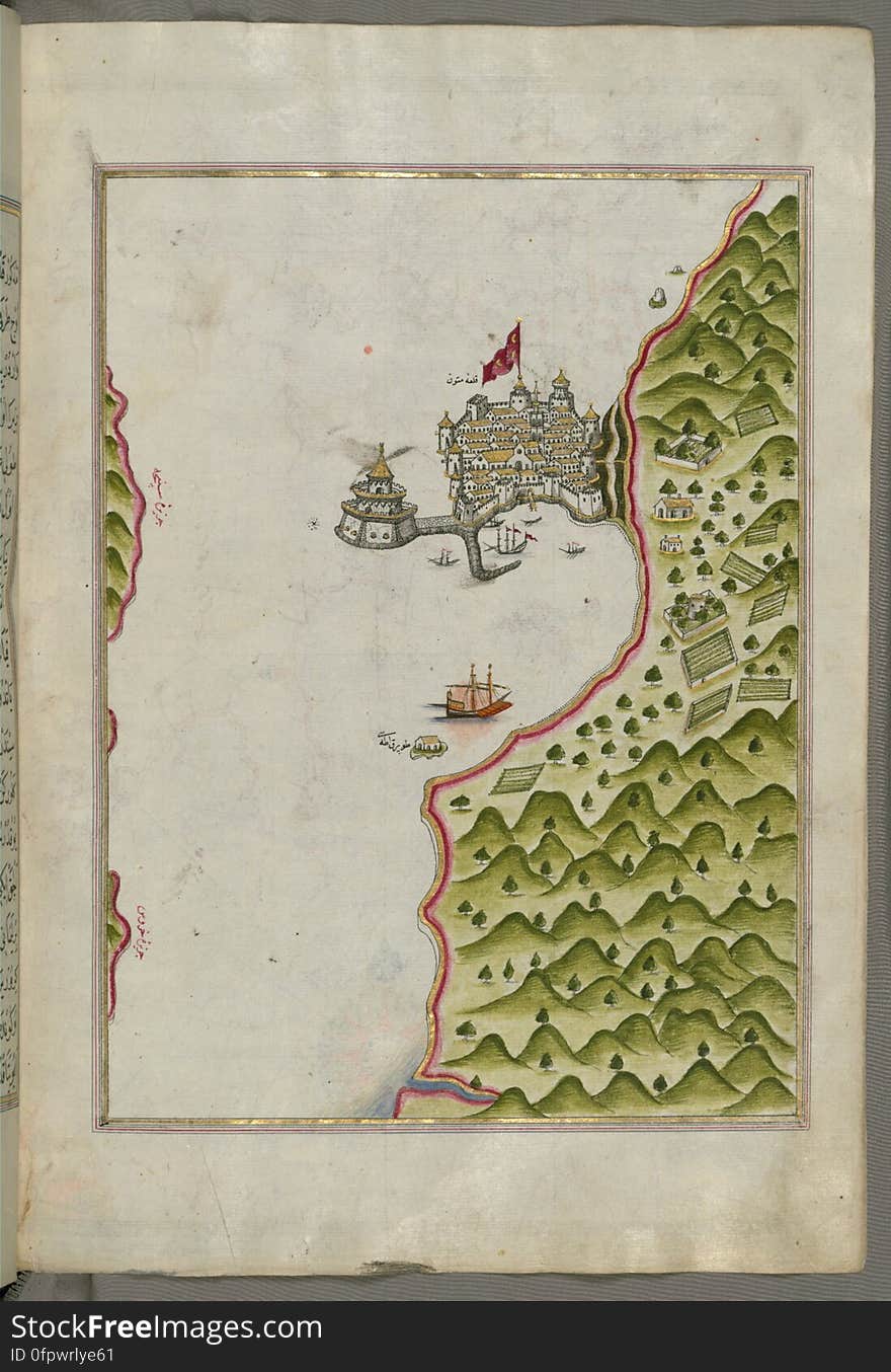
Illuminated Manuscript Map of the Bay of Salonica (Selānīk,Thessalonici) and the western coastline, from Book on Navig
The island of Cos (Stancho, İstanköy) facing the Anatolian mainland from Book on Navigation, Walters Art Museum Ms. W.
The Bay of Kerme east of east of Cos (Stancho, İstanköy) island from Book on Navigation, Walters Art Museum Ms. W.658
Illuminated Manuscript The Methana (Mutūn) fortress in the Saronikos (Aiyina) Bay, from Book on Navigation, W
Illuminated Manuscript, The Islands of Corfu (Kerkira, Kūrfūz) and Paxi (Paxoi) from Book on Navigation, Wal
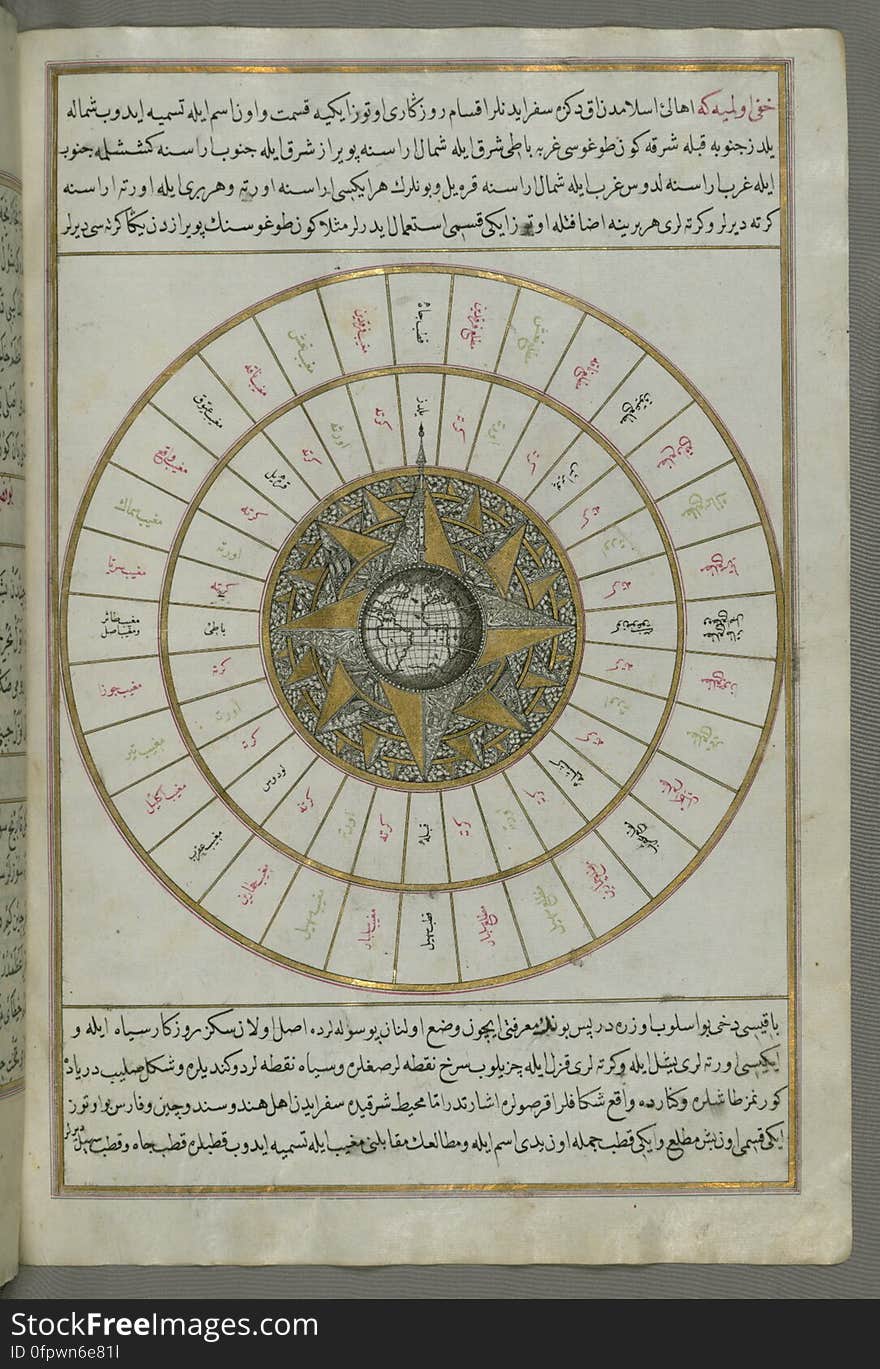
Illuminated Manuscript, Book on Navigation, Walters Art Museum Ms. W.658, Illuminated Manuscript of Three hundred and sixty Sufi q
Next page
2
/ 8
Home
Search for Proceeds free images